File:East end of the Niagara Peace Bridge, at Buffalo, and the south end of the Black Rock Canal -i.jpg
No higher resolution available.
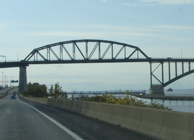
East_end_of_the_Niagara_Peace_Bridge,_at_Buffalo,_and_the_south_end_of_the_Black_Rock_Canal_-i.jpg (400 × 288 pixels, file size: 95 KB, MIME type: image/jpeg)
| This is a file from the Wikimedia Commons. Information from its description page there is shown below. Commons is a freely licensed media file repository. You can help. |
Summary
| Description | Peace Bridge from Interstate 190 southbound - Buffalo, New York |
| Date | |
| Source | 101908 593 |
| Author | Doug Kerr from Albany, NY, United States |
| Other versions |

| Camera location | | View this and other nearby images on: OpenStreetMap |
|---|
Licensing
This file is licensed under the Creative Commons Attribution-Share Alike 2.0 Generic license.
- You are free:
- to share – to copy, distribute and transmit the work
- to remix – to adapt the work
- Under the following conditions:
- attribution – You must give appropriate credit, provide a link to the license, and indicate if changes were made. You may do so in any reasonable manner, but not in any way that suggests the licensor endorses you or your use.
- share alike – If you remix, transform, or build upon the material, you must distribute your contributions under the same or compatible license as the original.
File history
Click on a date/time to view the file as it appeared at that time.
| Date/Time | Thumbnail | Dimensions | User | Comment | |
|---|---|---|---|---|---|
| current | 17:10, 26 October 2019 | | 400 × 288 (95 KB) | Geo Swan | File:Peace Bridge - Buffalo, New York, in 2008 -i.jpg cropped 61 % horizontally, 63 % vertically using CropTool with precise mode. |
File usage
The following pages on the English Wikipedia use this file (pages on other projects are not listed):