
Size of this preview: 429 × 599 pixels. Other resolutions: 172 × 240 pixels | 593 × 828 pixels.
Original file (593 × 828 pixels, file size: 19 KB, MIME type: image/png)
| This is a file from the Wikimedia Commons. Information from its description page there is shown below. Commons is a freely licensed media file repository. You can help. |
Summary
| Description |
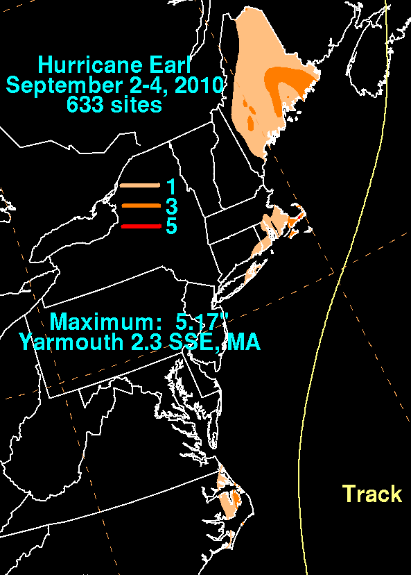
English: Storm total rainfall map of Hurricane Earl during September 2010. |
|||
| Date | ||||
| Source | WPC tropical cyclone rainfall data | |||
| Author | David Roth, Weather Prediction Center, Camp Springs, Maryland | |||
| Permission (Reusing this file) |
|
Original upload log
| Date/Time | Dimensions | User | Comment |
|---|---|---|---|
| 5 October 2010, 15:56:32 | 593 × 828 (21212 bytes) | Cyclonebiskit (talk · contribs) | {{Information |Description={{en|1=Earl remained a major hurricane into September 2nd, when it started to weaken due to drier air working into its circulation and lowering sea surface temperatures. The hurricane brushed by Cape Hatteras as a category 2 hu |
File history
Click on a date/time to view the file as it appeared at that time.
| Date/Time | Thumbnail | Dimensions | User | Comment | |
|---|---|---|---|---|---|
| current | 14:50, 6 January 2015 | | 593 × 828 (19 KB) | GifTagger | Bot: Converting file to superior PNG file. (Source: Earl_2010_rainfall.gif). This GIF was problematic due to non-greyscale color table. |
File usage
The following pages on the English Wikipedia use this file (pages on other projects are not listed):