
Size of this PNG preview of this SVG file: 652 × 521 pixels. Other resolutions: 300 × 240 pixels | 601 × 480 pixels | 961 × 768 pixels | 1,280 × 1,023 pixels | 2,560 × 2,046 pixels.
Original file (SVG file, nominally 652 × 521 pixels, file size: 1.01 MB)
| This is a file from the Wikimedia Commons. Information from its description page there is shown below. Commons is a freely licensed media file repository. You can help. |
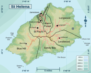
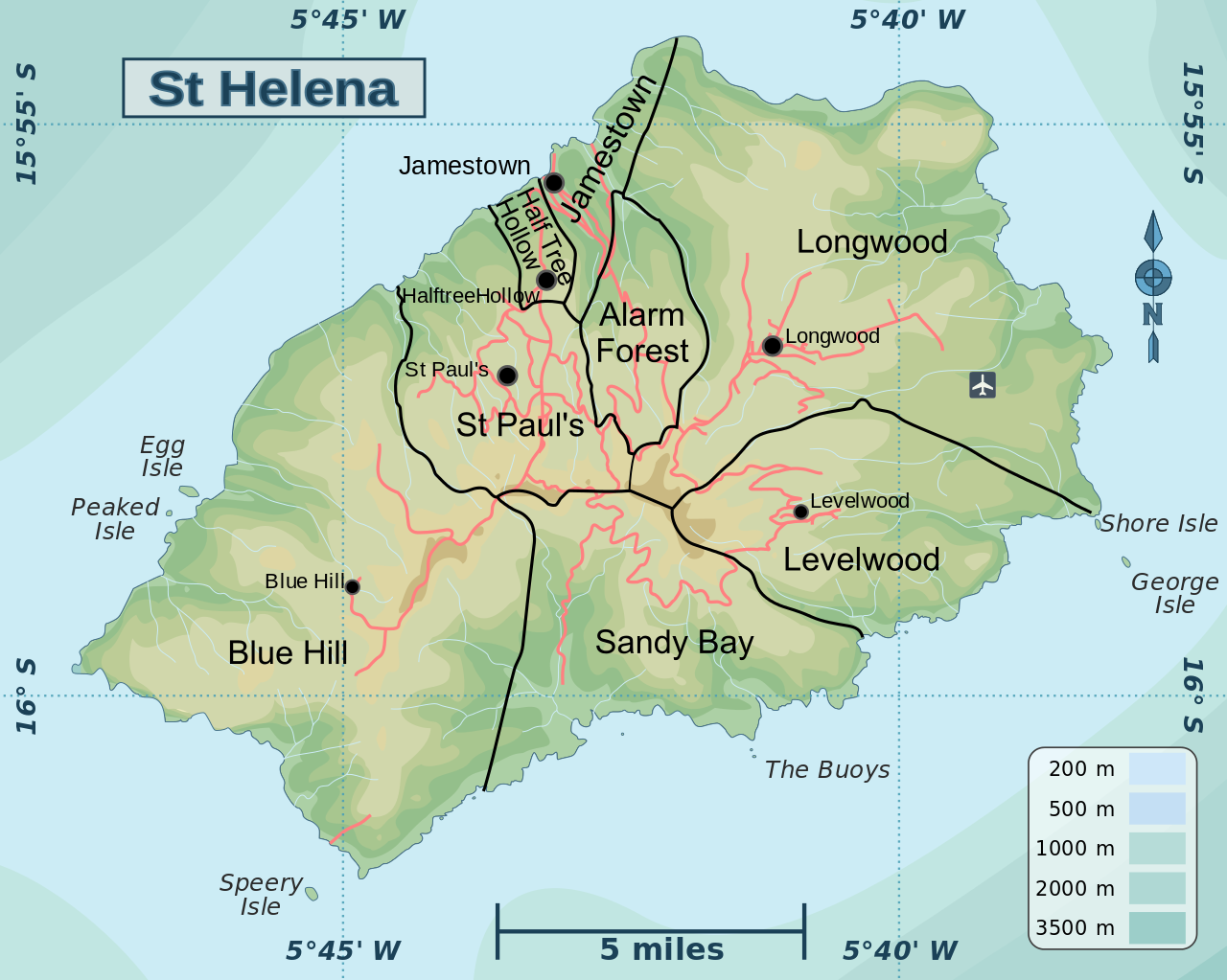
| Description | Map of St Helena showing the districts and main features | ||
| Date | |||
| Source | |||
| Author | Hogweard | ||
| Permission (Reusing this file) |
|
||
| Other versions |
|

File history
Click on a date/time to view the file as it appeared at that time.
| Date/Time | Thumbnail | Dimensions | User | Comment | |
|---|---|---|---|---|---|
| current | 21:58, 11 April 2016 | | 652 × 521 (1.01 MB) | Hogweard | Fixed font issue (I hope) |
| 21:55, 11 April 2016 |  | 652 × 521 (1.01 MB) | Hogweard | {{Information |Description=Map of St Helena showing the districts and main features |Source=*Saint Helena regions map.svg *District map of Saint Helena.png |Date=2016-04-... |
File usage
The following pages on the English Wikipedia use this file (pages on other projects are not listed):
Global file usage
The following other wikis use this file:
- Usage on id.wikipedia.org
- Usage on lt.wikipedia.org
- Usage on nl.wikipedia.org
- Usage on sl.wikipedia.org
- Usage on zh.wikipedia.org