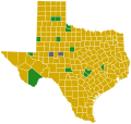
Size of this PNG preview of this SVG file: 800 × 507 pixels. Other resolutions: 320 × 203 pixels | 640 × 406 pixels | 1,024 × 649 pixels | 1,280 × 811 pixels | 2,560 × 1,623 pixels | 989 × 627 pixels.
Original file (SVG file, nominally 989 × 627 pixels, file size: 1.11 MB)
File history
Click on a date/time to view the file as it appeared at that time.
| Date/Time | Thumbnail | Dimensions | User | Comment | |
|---|---|---|---|---|---|
| current | 23:18, 6 July 2016 |  | 989 × 627 (1.11 MB) | Tdl1060 | Updated CA per http://vote.sos.ca.gov/returns/maps/president/party/democratic/ |
| 01:51, 2 July 2016 |  | 989 × 627 (1.11 MB) | Tdl1060 | Updated CA per http://vote.sos.ca.gov/returns/maps/president/party/democratic/ | |
| 17:18, 24 June 2016 |  | 989 × 627 (1.11 MB) | Tdl1060 | Updated Napa County margin per http://vote.sos.ca.gov/returns/maps/president/party/democratic/ | |
| 00:15, 24 June 2016 |  | 989 × 627 (1.11 MB) | Tdl1060 | Updated CA per http://vote.sos.ca.gov/returns/maps/president/party/democratic/ | |
| 02:06, 15 June 2016 |  | 989 × 627 (1.11 MB) | Tdl1060 | DC- Hillary 77.79%, Santa Clara County, CA - Hillary 58.8%. | |
| 00:18, 15 June 2016 |  | 989 × 627 (1.11 MB) | Tdl1060 | Updated CA counties per http://vote.sos.ca.gov/returns/maps/president/party/democratic/ | |
| 05:37, 14 June 2016 |  | 989 × 627 (1.23 MB) | Oganesson007 | Final Update and made significant changes. | |
| 19:06, 13 June 2016 |  | 555 × 352 (1.17 MB) | Tdl1060 | Updated CA per http://vote.sos.ca.gov/returns/maps/president/party/democratic/ | |
| 23:28, 11 June 2016 |  | 555 × 352 (1.51 MB) | Magog the Ogre | Puerto Rico | |
| 02:35, 11 June 2016 |  | 555 × 352 (1.52 MB) | Magog the Ogre | fix new county name in SD |
File usage
The following pages on the English Wikipedia use this file (pages on other projects are not listed):
Global file usage
The following other wikis use this file:
- Usage on es.wikipedia.org
- Usage on ru.wikipedia.org


