
Size of this preview: 800 × 439 pixels. Other resolutions: 320 × 176 pixels | 854 × 469 pixels.
Original file (854 × 469 pixels, file size: 273 KB, MIME type: image/png)
| This is a file from the Wikimedia Commons. Information from its description page there is shown below. Commons is a freely licensed media file repository. You can help. |
Summary
| Description |
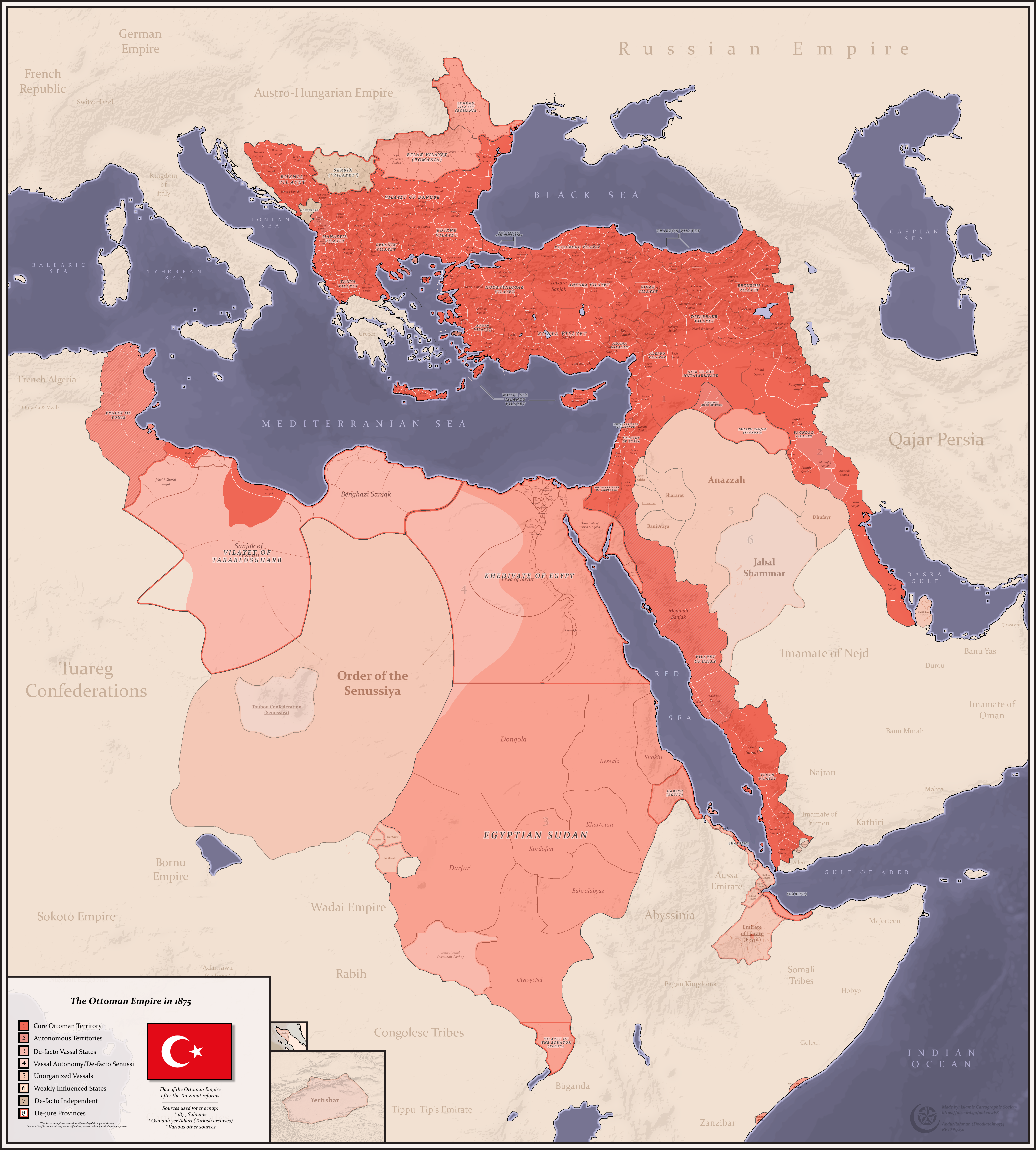
English: Map of the Danube Vilayet with its constituent sanjaks: Vidin, Tirnova, Rusçuk, Tulça, Varna, Sofya and Niš |
| Date | |
| Source | This is a cropped version of an original map created by a Wikipedia user that is posted in numerous articles in Wikipedia, URL: https://upload.wikimedia.org/wikipedia/commons/6/6a/Ottomans_1875.png |
| Author | The map was created by AbdurRahman AbdulMoneim, Wikimedia username: Userd898 |
Licensing
This file is licensed under the Creative Commons Attribution-Share Alike 4.0 International license.
- You are free:
- to share – to copy, distribute and transmit the work
- to remix – to adapt the work
- Under the following conditions:
- attribution – You must give appropriate credit, provide a link to the license, and indicate if changes were made. You may do so in any reasonable manner, but not in any way that suggests the licensor endorses you or your use.
- share alike – If you remix, transform, or build upon the material, you must distribute your contributions under the same or compatible license as the original.
File history
Click on a date/time to view the file as it appeared at that time.
| Date/Time | Thumbnail | Dimensions | User | Comment | |
|---|---|---|---|---|---|
| current | 18:17, 8 April 2023 | | 854 × 469 (273 KB) | VMORO | Uploaded a work by The map was created by AbdurRahman AbdulMoneim, Wikimedia username: Userd898 from This is a cropped version of an original map created by a Wikipedia user that is posted in numerous articles in Wikipedia, URL: https://upload.wikimedia.org/wikipedia/commons/6/6a/Ottomans_1875.png with UploadWizard |
File usage
The following pages on the English Wikipedia use this file (pages on other projects are not listed):