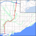
Size of this PNG preview of this SVG file: 600 × 600 pixels. Other resolutions: 240 × 240 pixels | 480 × 480 pixels | 768 × 768 pixels | 1,024 × 1,024 pixels | 2,048 × 2,048 pixels | 1,420 × 1,420 pixels.
Original file (SVG file, nominally 1,420 × 1,420 pixels, file size: 545 KB)
File history
Click on a date/time to view the file as it appeared at that time.
| Date/Time | Thumbnail | Dimensions | User | Comment | |
|---|---|---|---|---|---|
| current | 02:13, 23 August 2010 |  | 1,420 × 1,420 (545 KB) | Floydian | Complete rest of route, expand scope to the east to add a context map of GTA. Add rivers and parkland. |
| 05:44, 24 July 2010 |  | 840 × 1,420 (305 KB) | Floydian | Adjust colours, add rails, some interchanges | |
| 18:51, 20 July 2010 |  | 840 × 1,420 (29 KB) | Floydian | Fix issues | |
| 18:34, 20 July 2010 |  | 1,700 × 2,800 (31 KB) | Floydian | {{Information |Description=A map of the Don Valley Parkway in Toronto, Canada, showing the freeways and arterial roads in the vicinity of it and Lake Ontario. First draft (no interchanges or urban/green landuse) |Source={{own}} based on the map on page 3 |
File usage
The following page uses this file:
Global file usage
The following other wikis use this file:
- Usage on fa.wikipedia.org
- Usage on fr.wikipedia.org
- Usage on kn.wikipedia.org
- Usage on www.wikidata.org
- Usage on zh.wikipedia.org