Size of this preview: 800 × 359 pixels. Other resolutions: 320 × 144 pixels | 640 × 287 pixels | 1,024 × 459 pixels | 1,280 × 574 pixels | 2,568 × 1,152 pixels.
Original file (2,568 × 1,152 pixels, file size: 554 KB, MIME type: image/png)
| This is a file from the Wikimedia Commons. Information from its description page there is shown below. Commons is a freely licensed media file repository. You can help. |
Summary
| Description |
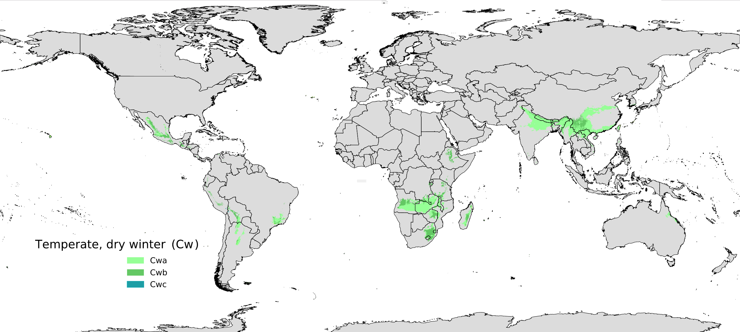
Español: Mapa global del clima mesotérmico de invierno seco o de altitud Cw de acuerdo al sistema de Köppen-Geiger para el periodo 1980-2016 English: Global map for dry winter temperate climate (Cw) |
| Date | |
| Source | Own work, derived from File:Koppen-Geiger Map C present.svg |
| Author | Maulucioni, based on a previous work by Beck, H.E. et al. 2018 |
Licensing
I, the copyright holder of this work, hereby publish it under the following license:
This file is licensed under the Creative Commons Attribution-Share Alike 4.0 International license.
- You are free:
- to share – to copy, distribute and transmit the work
- to remix – to adapt the work
- Under the following conditions:
- attribution – You must give appropriate credit, provide a link to the license, and indicate if changes were made. You may do so in any reasonable manner, but not in any way that suggests the licensor endorses you or your use.
- share alike – If you remix, transform, or build upon the material, you must distribute your contributions under the same or compatible license as the original.
File history
Click on a date/time to view the file as it appeared at that time.
| Date/Time | Thumbnail | Dimensions | User | Comment | |
|---|---|---|---|---|---|
| current | 16:38, 31 May 2019 | | 2,568 × 1,152 (554 KB) | Maulucioni | Minor edit |
| 13:11, 31 May 2019 |  | 2,572 × 1,164 (554 KB) | Maulucioni | User created page with UploadWizard |
File usage
The following pages on the English Wikipedia use this file (pages on other projects are not listed):
Global file usage
The following other wikis use this file:
- Usage on eo.wikipedia.org
- Usage on es.wikipedia.org
- Usage on fa.wikipedia.org
- Usage on fr.wikipedia.org
- Usage on hu.wikipedia.org