Size of this preview: 800 × 495 pixels. Other resolutions: 320 × 198 pixels | 640 × 396 pixels | 1,100 × 680 pixels.
Original file (1,100 × 680 pixels, file size: 121 KB, MIME type: image/png)
File history
Click on a date/time to view the file as it appeared at that time.
| Date/Time | Thumbnail | Dimensions | User | Comment | |
|---|---|---|---|---|---|
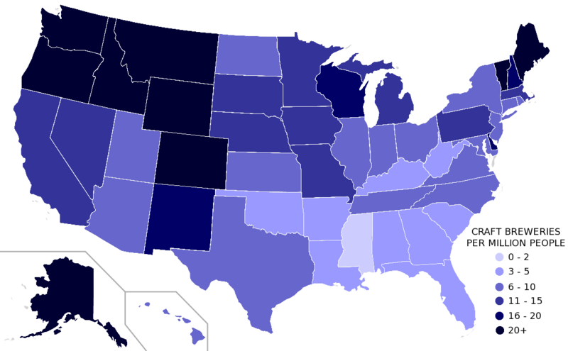
| current | 16:51, 19 April 2012 |  | 1,100 × 680 (121 KB) | Alataristarion | I updated this map using the 2010 census data for states (found here: http://en.wikipedia.org/wiki/List_of_U.S._states_and_territories_by_population) as well as the most recent data from the brewery data source used to create the original map (http://w... |
| 07:31, 9 March 2008 |  | 1,013 × 567 (42 KB) | Northwest-historian | {{Information |Description=United States microbreweries, regional breweries, and brew pubs per capita by state. Brewery data from the state locator at [http://www.beertown.org/craftbrewing/locator/breweries.aspx]. Population data from Wikipedia. National |
File usage
The following page uses this file: