Size of this preview: 727 × 599 pixels. Other resolutions: 291 × 240 pixels | 583 × 480 pixels | 932 × 768 pixels | 1,243 × 1,024 pixels | 2,485 × 2,048 pixels | 2,605 × 2,147 pixels.
Original file (2,605 × 2,147 pixels, file size: 2.51 MB, MIME type: image/jpeg)
File history
Click on a date/time to view the file as it appeared at that time.
| Date/Time | Thumbnail | Dimensions | User | Comment | |
|---|---|---|---|---|---|
| current | 23:19, 27 April 2020 |  | 2,605 × 2,147 (2.51 MB) | Saber68 | Une nouvelle version améliorée de la même carte |
| 04:18, 28 May 2015 |  | 2,920 × 2,448 (4.09 MB) | Saber68 | version améliorée | |
| 04:17, 28 May 2015 |  | 2,920 × 2,448 (4.09 MB) | Saber68 | version améliorée | |
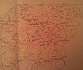
| 02:01, 24 December 2013 |  | 2,920 × 2,448 (2.49 MB) | Saber68 | {{Information |Description ={{fr|1=Cartographie de la confédérations et tribus de la Grande Kabylie (Tamawya Taqbaylit) - Algérie. }} |Source =Carte dressée par le Service Cartographique du Gouvernement Général de l'Algérie (1940) |... |
File usage
The following pages on the English Wikipedia use this file (pages on other projects are not listed):
Global file usage
The following other wikis use this file:
- Usage on ar.wikipedia.org
- رشيد حالت
- معركة الثنية (1837)
- جان فرانسوا جنتيل
- محطة قطار الثنية
- محطة قطار سوق الحد
- محطة قطار بني عمران
- محطة قطار عمال
- سد بني عمران
- شاطئ الصخيرات (الجزائر)
- محطة قطار تيزي وزو
- محطة قطار قورصو
- محطة قطار بومرداس
- محطة قطار تيجلابين
- جبال الخشنة
- جبال ساحل الجزائر
- جبل بوزريعة
- آيث إيراثن
- زاوية سيدي سحنون الإيراثني
- خط سكة حديد من تيزي وزو إلى الثنية
- تيليفيريك تيزي وزو
- محمد العيشاوي
- زاوية سيدي بوسحاقي
- عروش زواوة
- عرش أمازيغي
- زاوية سيدي يحي العيدلي
- زاوية سيدي أحمد زروق البرنسي
- أنفاق ملبو
- زاوية سيدي بلعموري
- لالة خديجة (جبل)
- موسى الحاج
- ثاجماعث
- زاوية سيدي عبد الرحمان الثعالبي
- زاوية سيدي أمحمد السعدي
- Usage on bn.wikipedia.org
- Usage on fr.wikipedia.org
- Usage on ha.wikipedia.org
- Usage on hi.wikipedia.org
- Usage on id.wikipedia.org
- Usage on pt.wikipedia.org