
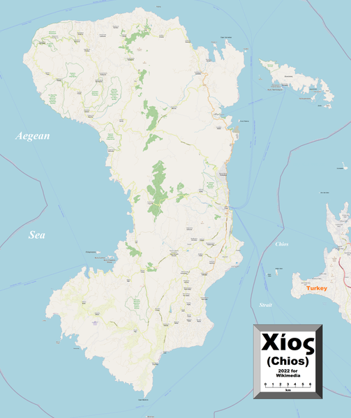
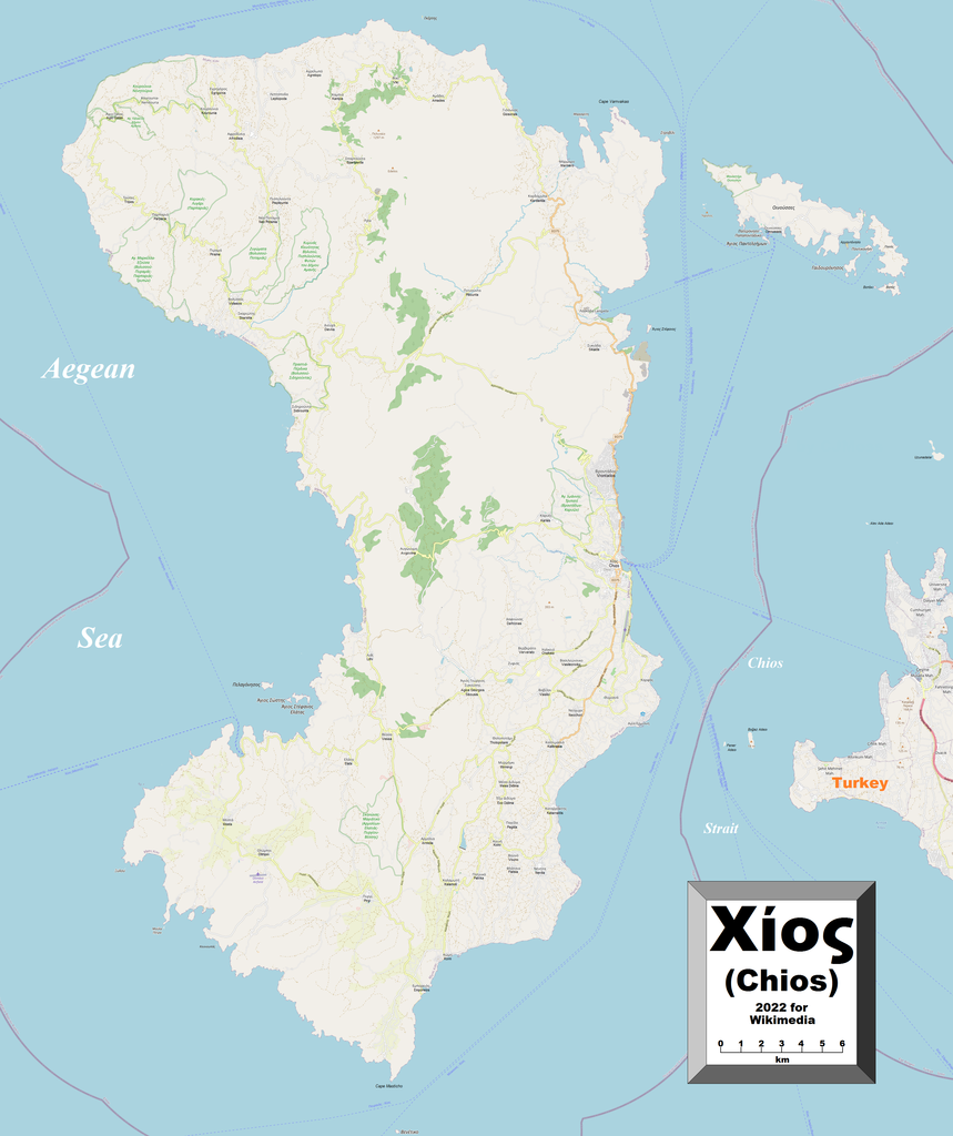
Size of this preview: 503 × 599 pixels. Other resolutions: 201 × 240 pixels | 403 × 480 pixels | 644 × 768 pixels | 859 × 1,024 pixels | 1,719 × 2,048 pixels | 3,048 × 3,632 pixels.
Original file (3,048 × 3,632 pixels, file size: 2.79 MB, MIME type: image/png)
| This is a file from the Wikimedia Commons. Information from its description page there is shown below. Commons is a freely licensed media file repository. You can help. |
Summary
| Description |
English: This map of Chios shows the island's towns, villages and some other geographical details, and is likely the most comprehensive map of the island in this respect that you'll find anywhere online. It has been stitched together from panels of Open Street Map (which is freely licensed to all) with details plotted by the uploader, including transliterations of the towns' and villages' names, which were in Greek only at the source. |
| Date | |
| Source | Own work |
| Author | Kelisi |
| Permission (Reusing this file) |
The aforesaid website is freely usable to all. |
Licensing
I, the copyright holder of this work, hereby publish it under the following license:
This file is licensed under the Creative Commons Attribution-Share Alike 4.0 International license.
- You are free:
- to share – to copy, distribute and transmit the work
- to remix – to adapt the work
- Under the following conditions:
- attribution – You must give appropriate credit, provide a link to the license, and indicate if changes were made. You may do so in any reasonable manner, but not in any way that suggests the licensor endorses you or your use.
- share alike – If you remix, transform, or build upon the material, you must distribute your contributions under the same or compatible license as the original.
File history
Click on a date/time to view the file as it appeared at that time.
| Date/Time | Thumbnail | Dimensions | User | Comment | |
|---|---|---|---|---|---|
| current | 05:12, 10 May 2022 | | 3,048 × 3,632 (2.79 MB) | Kelisi | Uploaded own work with UploadWizard |
File usage
The following pages on the English Wikipedia use this file (pages on other projects are not listed):