
Size of this PNG preview of this SVG file: 750 × 600 pixels. Other resolutions: 300 × 240 pixels | 600 × 480 pixels | 960 × 768 pixels | 1,280 × 1,024 pixels | 2,560 × 2,048 pixels | 925 × 740 pixels.
Original file (SVG file, nominally 925 × 740 pixels, file size: 173 KB)
| This is a file from the Wikimedia Commons. Information from its description page there is shown below. Commons is a freely licensed media file repository. You can help. |
Summary
| Description |
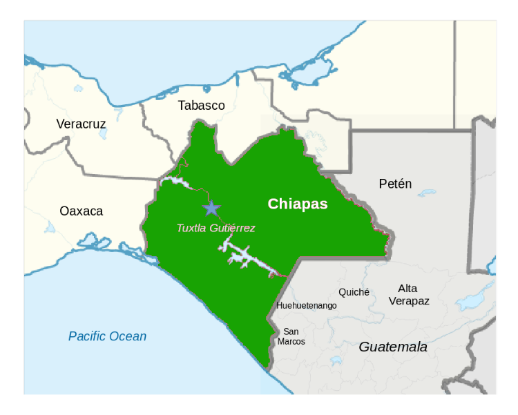
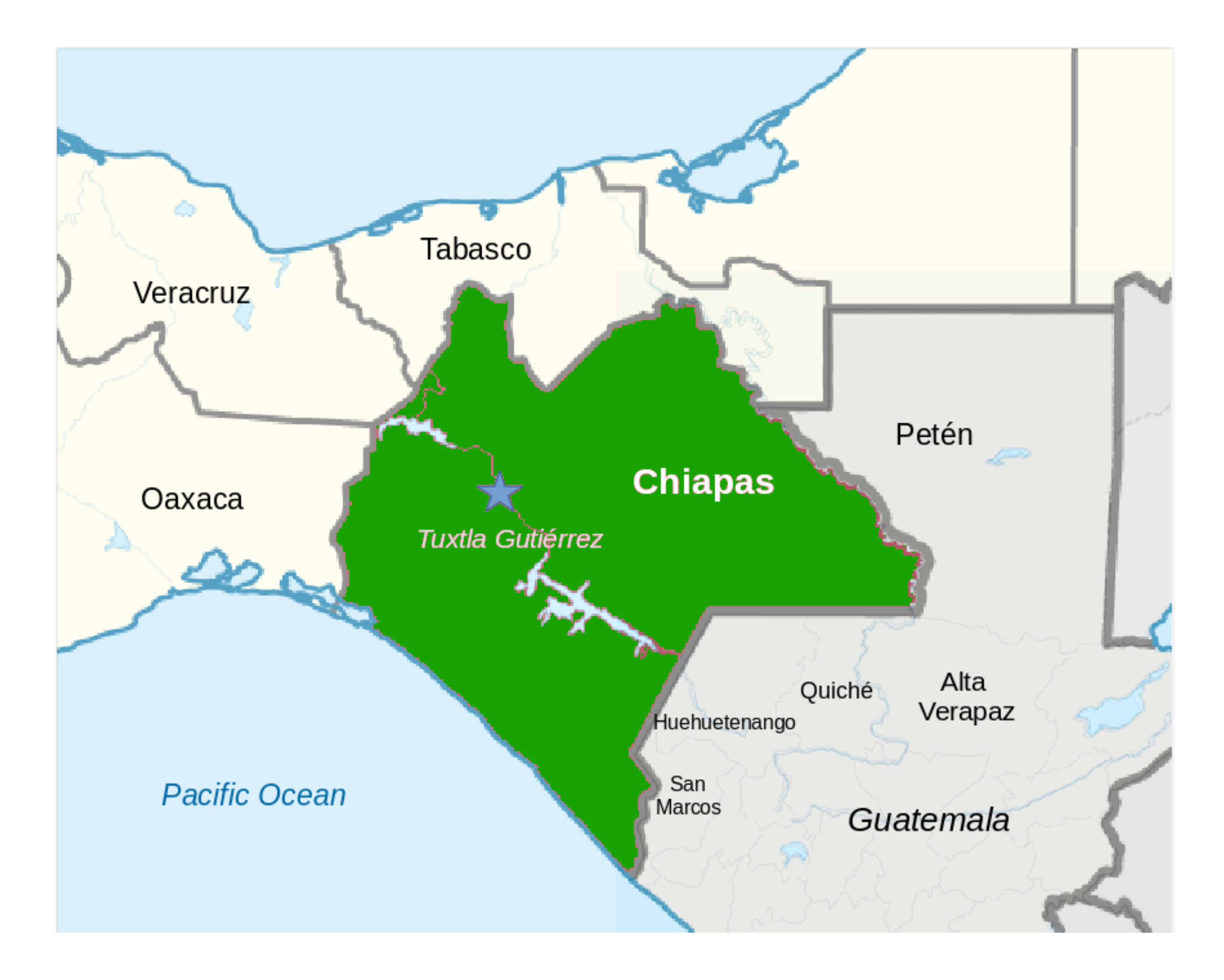
English: Mexican state of Chiapas and its neighbors
Español: Estado de Chiapas, en México, y sus vecinos |
| Date | |
| Source | Modified File:Chiapas in Mexico (location map scheme).svg and File:Guatemala location map.svg. Also used File:Municipios de Chiapas (2020).svg (for states) and File:Tuxtla Gutierrez en Chiapas.svg (for Tuxtla location) |
| Author | Thinker78 |
| Permission (Reusing this file) |
This file is licensed under the Creative Commons Attribution 4.0 International license.
|
| Other versions |
This file is licensed under the Creative Commons Attribution 3.0 Unported license. Attribution: TUBS
|
.svg)
.svg)
| Camera location | | View this and other nearby images on: OpenStreetMap |
|---|
Made with w:LibreOffice Draw
Licensing
This file is licensed under the Creative Commons Attribution 4.0 International license.
- You are free:
- to share – to copy, distribute and transmit the work
- to remix – to adapt the work
- Under the following conditions:
- attribution – You must give appropriate credit, provide a link to the license, and indicate if changes were made. You may do so in any reasonable manner, but not in any way that suggests the licensor endorses you or your use.
File history
Click on a date/time to view the file as it appeared at that time.
| Date/Time | Thumbnail | Dimensions | User | Comment | |
|---|---|---|---|---|---|
| current | 22:04, 31 March 2024 | | 925 × 740 (173 KB) | Thinker78 | added capital label, changed color of chiapas and position of its label |
| 07:08, 27 March 2024 |  | 909 × 744 (269 KB) | Thinker78 | added capital of chiapas | |
| 06:52, 27 March 2024 |  | 909 × 744 (268 KB) | Thinker78 | Uploaded own work with UploadWizard |
File usage
The following pages on the English Wikipedia use this file (pages on other projects are not listed):