
Size of this PNG preview of this SVG file: 532 × 446 pixels. Other resolutions: 286 × 240 pixels | 573 × 480 pixels | 916 × 768 pixels | 1,222 × 1,024 pixels | 2,443 × 2,048 pixels.
Original file (SVG file, nominally 532 × 446 pixels, file size: 666 KB)
| This is a file from the Wikimedia Commons. Information from its description page there is shown below. Commons is a freely licensed media file repository. You can help. |
Summary
| Description |
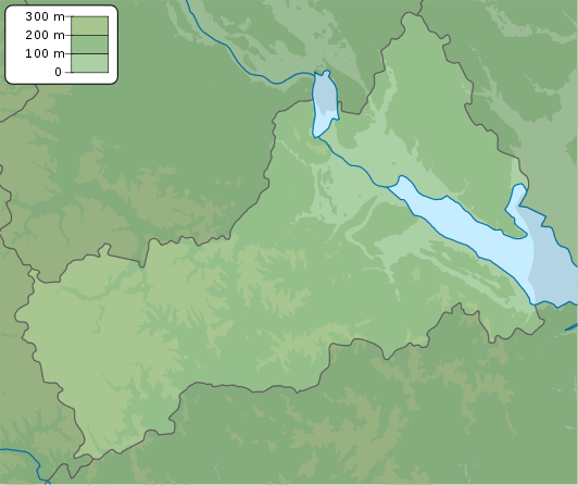
English: Physical map of Cherkasy province, Ukraine
Русский: Физическая карта Черкасской области, Украина |
| Date | |
| Source | Own work |
| Author | Urutseg |
| SVG development | This locator map was created with Inkscape. |
Licensing
| I, the copyright holder of this work, release this work into the public domain. This applies worldwide. In some countries this may not be legally possible; if so: I grant anyone the right to use this work for any purpose, without any conditions, unless such conditions are required by law. |
File history
Click on a date/time to view the file as it appeared at that time.
| Date/Time | Thumbnail | Dimensions | User | Comment | |
|---|---|---|---|---|---|
| current | 18:05, 22 December 2010 | | 532 × 446 (666 KB) | Urutseg |
File usage
The following pages on the English Wikipedia use this file (pages on other projects are not listed):
Global file usage
The following other wikis use this file:
- Usage on ar.wikipedia.org
- Usage on be.wikipedia.org
- Usage on bg.wikipedia.org
- Usage on ceb.wikipedia.org
- Usage on ce.wikipedia.org
- Usage on da.wikipedia.org
- Usage on de.wikipedia.org
- Usage on eo.wikipedia.org
- Usage on es.wikipedia.org
- Usage on fa.wikipedia.org
- Usage on fi.wikipedia.org
- Usage on fr.wikipedia.org
- Tcherkassy
- Ouman
- Tchyhyryne
- Kaniv
- Chpola
- Horodychtche
- Jachkiv
- Korsoun-Chevtchenkivskyï
- Khrystynivka
- Kamianka (oblast de Tcherkassy)
- Monastyrychtche
- Smila
- Talne
- Vatoutine
- Zolotonocha
- Zvenyhorodka
- Dobrovody
- Modèle:Géolocalisation/Oblast de Tcherkassy
- Mejyritch
- Babanka
- Ivanhorod
- Parc national de Kholodny Yar
- Talianki (site archéologique)
- Usage on he.wikipedia.org
- Usage on hy.wikipedia.org
- Usage on ja.wikipedia.org
- Usage on ky.wikipedia.org
- Usage on lv.wikipedia.org
View more global usage of this file.