
Size of this PNG preview of this SVG file: 450 × 600 pixels. Other resolutions: 180 × 240 pixels | 360 × 480 pixels | 576 × 768 pixels | 768 × 1,024 pixels | 1,536 × 2,048 pixels | 714 × 952 pixels.
Original file (SVG file, nominally 714 × 952 pixels, file size: 213 KB)
| This is a file from the Wikimedia Commons. Information from its description page there is shown below. Commons is a freely licensed media file repository. You can help. |
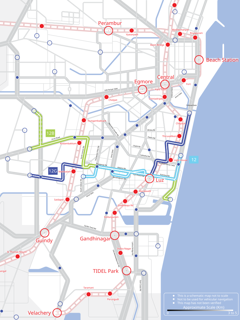
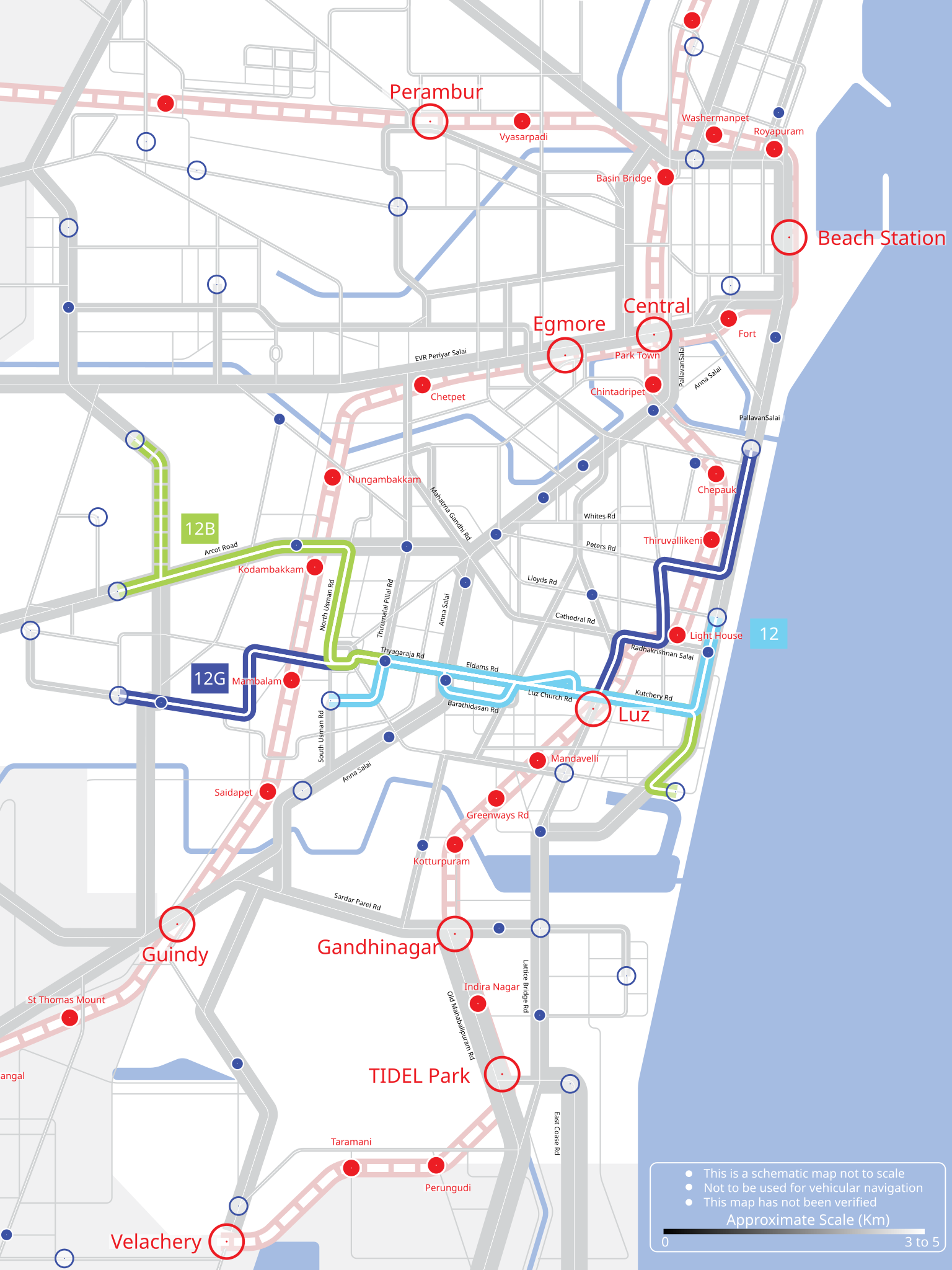
| Description | Schematic road and rail map of Chennai Metropolitan Area | ||
| Date | 14 June 07 | ||
| Source | Own work | ||
| Author |
|
||
| Permission (Reusing this file) |
I, the copyright holder of this work, hereby publish it under the following license: This file is licensed under the Creative Commons Attribution-Share Alike 2.5 Generic license.
|
||
| Other versions |
 |
File history
Click on a date/time to view the file as it appeared at that time.
| Date/Time | Thumbnail | Dimensions | User | Comment | |
|---|---|---|---|---|---|
| current | 12:08, 1 December 2007 | | 714 × 952 (213 KB) | Planemad | Checking |
| 21:57, 20 September 2007 |  | 714 × 952 (253 KB) | Platonides | Reverted to version as of 19:33, 16 June 2007 - 19 sep 2007version points to a external raster image. | |
| 08:46, 19 September 2007 |  | 1,169 × 1,429 (194 KB) | Planemad | ||
| 19:33, 16 June 2007 |  | 714 × 952 (253 KB) | Planemad | ||
| 14:53, 16 June 2007 |  | 714 × 952 (224 KB) | Planemad | test new scheme | |
| 14:36, 16 June 2007 |  | 714 × 952 (224 KB) | Planemad | ||
| 13:10, 16 June 2007 |  | 714 × 952 (213 KB) | Planemad | incl street names | |
| 19:29, 14 June 2007 |  | 1,348 × 1,735 (154 KB) | Planemad | upd, test for route 12 | |
| 19:03, 13 June 2007 |  | 674 × 867 (42 KB) | Planemad | {{Information |Description=Schematic road and rail map of Chennai Metropolitan Area |Date= 14 June 07 |Author= w:user:PlaneMad |Source=self made |Permission={{self|cc-by-sa-2.5}} |other_versions= }} Category:Chennai Category:HDR |
File usage
No pages on the English Wikipedia use this file (pages on other projects are not listed).