Size of this preview: 629 × 599 pixels. Other resolutions: 252 × 240 pixels | 504 × 480 pixels | 658 × 627 pixels.
Original file (658 × 627 pixels, file size: 4.78 MB, MIME type: image/png)
| This is a file from the Wikimedia Commons. Information from its description page there is shown below. Commons is a freely licensed media file repository. You can help. |
Summary
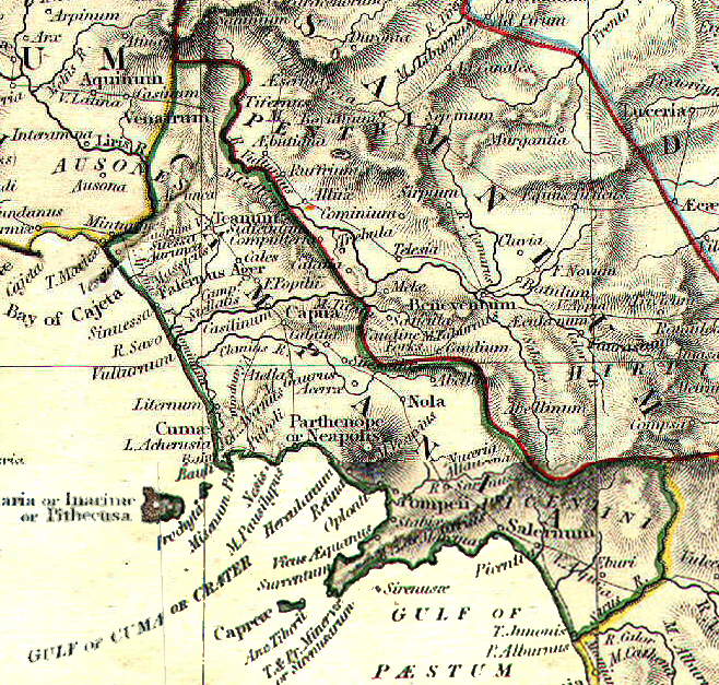
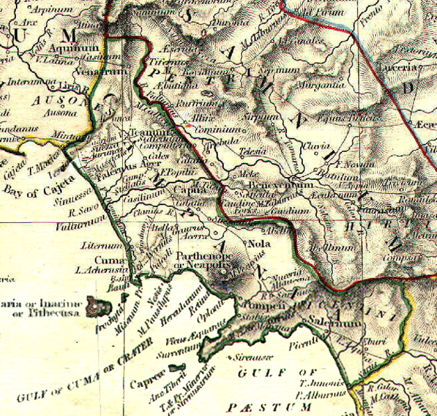
| Description | Reference map for Roman Campania felix | |||||||||||||||||||||||
| Date | ||||||||||||||||||||||||
| Source | The Historical Atlas by William R. Shepherd, 1911 | |||||||||||||||||||||||
| Author |
|
|||||||||||||||||||||||
| Permission (Reusing this file) |
public domain because its copyright has expired | |||||||||||||||||||||||
.png)
Licensing
|
This work is in the public domain in its country of origin and other countries and areas where the copyright term is the author's life plus 70 years or fewer. | |
| This file has been identified as being free of known restrictions under copyright law, including all related and neighboring rights. | |
File history
Click on a date/time to view the file as it appeared at that time.
| Date/Time | Thumbnail | Dimensions | User | Comment | |
|---|---|---|---|---|---|
| current | 09:49, 3 May 2008 | | 658 × 627 (4.78 MB) | GlióPanteco | == Dettagli == {{Information |Description=Reference map for Roman Samnium, Frentani and Sabina |Source=''The Historical Atlas'' by William R. Shepherd, 1911 |Date=May 1st 2008 |Author=William R. Shepherd |Permission=public domain because its copyright has |
File usage
The following pages on the English Wikipedia use this file (pages on other projects are not listed):
Global file usage
The following other wikis use this file:
- Usage on ca.wikipedia.org
- Usage on es.wikipedia.org
- Usage on fr.wikipedia.org
- Usage on it.wikipedia.org
- Usage on www.wikidata.org