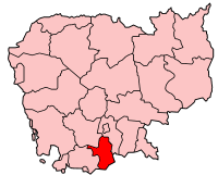
Cambodia-Takeo.png (200 × 161 pixels, file size: 6 KB, MIME type: image/png)
File history
Click on a date/time to view the file as it appeared at that time.
| Date/Time | Thumbnail | Dimensions | User | Comment | |
|---|---|---|---|---|---|
| current | 08:54, 20 December 2005 |  | 200 × 161 (6 KB) | Golbez | Map of Cambodia showing Takeo province. Made by User:Golbez based on a map by Morwen on en.wikipedia.org. Category:Maps of Cambodia |
File usage
No pages on the English Wikipedia use this file (pages on other projects are not listed).
Global file usage
The following other wikis use this file:
- Usage on ca.wikipedia.org
- Usage on es.wikipedia.org
- Usage on id.wikipedia.org
- Usage on km.wikipedia.org
- ខេត្តតាកែវ
- ស្រុកបាទី
- ស្រុកបូរីជលសារ
- ស្រុកកោះអណ្ដែត
- ស្រុកព្រៃកប្បាស
- ក្រុងដូនកែវ
- ស្រុកត្រាំកក់
- ស្រុកទ្រាំង
- ស្រុកសំរោង(ខេត្តតាកែវ)
- ទំព័រគំរូ:ខេត្តតាកែវ
- ក្រុងតាកែវ
- ឃុំអង្គរបូរី
- ឃុំបាស្រែ
- ឃុំគោកធ្លក
- ឃុំព្រែកផ្ទោល
- ឃុំព្រៃផ្គាំ
- ឃុំពន្លៃ(ស្រុកអង្គរបុរី)
- ឃុំដូង(ស្រុកបាទី)
- ឃុំកណ្តឹង
- ឃុំកុមាររាជា
- ឃុំក្រាំងធ្នង់
- ឃុំបូរីជលសារ
- ឃុំអង្គប្រាសាទ
- ឃុំក្រពុំឈូក
- ឃុំអង្កាញ់(ស្រុកព្រៃកប្បាស)
- ឃុំបឹងត្រាញ់ខាងជើង
- ឃុំបារាយណ៍ (ស្រុកដូនកែវ)
- ឃុំអង្គតាសោម
- ឃុំត្រពាំងធំខាងជើង
- ឃុំអង្គខ្នុរ
- ឃុំជីខ្មា
- ឃុំប្រាំបីមុំ
- ឃុំអង្គកែវ
- ឃុំព្រៃស្លឹក
- ឃុំរនាម
- ឃុំសន្លុង
- ឃុំស្មោង
- ឃុំស្រង៉ែ(ស្រុកទ្រាំង)
- ឃុំត្រឡាច
- ឃុំត្រពាំងធំខាងត្បូង
- ឃុំជាងទង
- ឃុំគុស
- ឃុំជ័យជោគ
- ឃុំដូងខ្ពស់
View more global usage of this file.


