Size of this preview: 470 × 600 pixels. Other resolutions: 188 × 240 pixels | 376 × 480 pixels | 602 × 768 pixels | 1,036 × 1,322 pixels.
Original file (1,036 × 1,322 pixels, file size: 440 KB, MIME type: image/jpeg)
| This is a file from the Wikimedia Commons. Information from its description page there is shown below. Commons is a freely licensed media file repository. You can help. |
| Description |
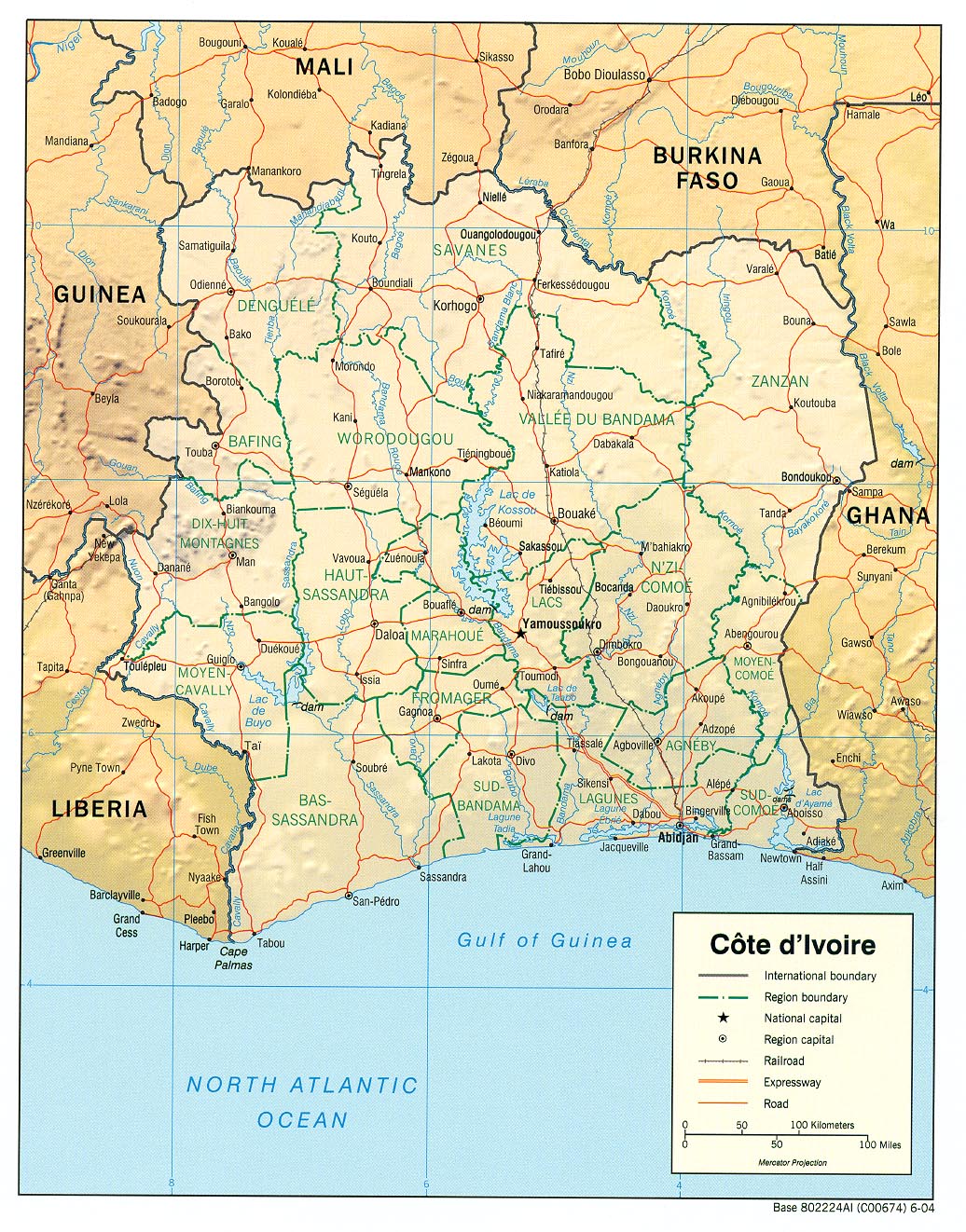
English: haded relief map of Côte d'Ivoire. |
|||
| Date | ||||
| Source | [1] from the Perry-Castañeda Library Map Collection. | |||
| Author | CIA | |||
| Permission (Reusing this file) |
|

![[1]](http://www.lib.utexas.edu/maps/africa/cote_divoire_rel04.jpg)
File history
Click on a date/time to view the file as it appeared at that time.
| Date/Time | Thumbnail | Dimensions | User | Comment | |
|---|---|---|---|---|---|
| current | 11:11, 21 February 2006 | | 1,036 × 1,322 (440 KB) | Lupo | Shaded relief map of Côte d'Ivoire. Source: [http://www.lib.utexas.edu/maps/africa/cote_divoire_rel04.jpg] from the [http://www.lib.utexas.edu/maps/cote_d'ivoire.html Perry-Castañeda Library Map Collection]. {{PD-USGov-CIA}} [[Category:Maps of C� |
File usage
The following pages on the English Wikipedia use this file (pages on other projects are not listed):
Global file usage
The following other wikis use this file:
- Usage on als.wikipedia.org
- Usage on ar.wikipedia.org
- Usage on az.wikipedia.org
- Usage on be.wikipedia.org
- Usage on bn.wikipedia.org
- Usage on ca.wikipedia.org
- Usage on ckb.wikipedia.org
- Usage on cv.wikipedia.org
- Usage on de.wikipedia.org
- Usage on es.wikipedia.org
- Usage on fa.wikipedia.org
- Usage on fr.wikipedia.org
- Usage on fr.wikinews.org
- Usage on fy.wikipedia.org
- Usage on gd.wikipedia.org
- Usage on gl.wikipedia.org
- Usage on hi.wikipedia.org
- Usage on id.wikipedia.org
- Usage on it.wikipedia.org
- Usage on ka.wikipedia.org
- Usage on kbp.wikipedia.org
- Usage on kk.wikipedia.org
- Usage on lfn.wikipedia.org
- Usage on ms.wikipedia.org
- Usage on mzn.wikipedia.org
- Usage on nl.wikipedia.org
- Usage on pl.wikipedia.org
- Usage on ru.wikipedia.org
- Usage on sa.wikipedia.org
- Usage on ta.wikipedia.org
- Usage on tt.wikipedia.org
View more global usage of this file.