No higher resolution available.
Butte_Falls_Ranger_District_map.jpg (171 × 136 pixels, file size: 9 KB, MIME type: image/jpeg)
| This is a file from the Wikimedia Commons. Information from its description page there is shown below. Commons is a freely licensed media file repository. You can help. |
Summary
| Description |
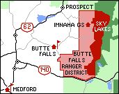
English: Map of Butte Falls Ranger District in western Oregon |
| Date |
Unknown date, dowhloaded 24 June 2008 |
| Source |
http://www.fs.fed.us/r6/rogue-siskiyou/contact/butte.shtml |
| Author | United States Forest service |
| Other versions | Cropped original map and added Imnaha Guard Station |
Licensing
This image is a work of the Forest Service of the United States Department of Agriculture. As a work of the U.S. federal government, the image is in the public domain.
|
Original upload log
The original description page was here. All following user names refer to en.wikipedia.
- 2008-06-25 01:07 Orygun 171×136× (9275 bytes) {{Information |Description=Map of Butte Falls Ranger District in western Oregon |Source=http://www.fs.fed.us/r6/rogue-siskiyou/contact/butte.shtml |Date=Unknown, dowhloaded 24 June 2008 |Author=United States Forest service |Permission=Public Domain |other
File history
Click on a date/time to view the file as it appeared at that time.
| Date/Time | Thumbnail | Dimensions | User | Comment | |
|---|---|---|---|---|---|
| current | 14:38, 9 September 2011 | | 171 × 136 (9 KB) | File Upload Bot (Magnus Manske) | {{BotMoveToCommons|en.wikipedia|year={{subst:CURRENTYEAR}}|month={{subst:CURRENTMONTHNAME}}|day={{subst:CURRENTDAY}}}} {{Information |Description={{en|Map of Butte Falls Ranger District in western Oregon}} |Source=Transferred from [http://en.wikipedia.or |
File usage
The following pages on the English Wikipedia use this file (pages on other projects are not listed):