
Size of this preview: 739 × 600 pixels. Other resolutions: 296 × 240 pixels | 591 × 480 pixels | 946 × 768 pixels | 1,262 × 1,024 pixels | 2,331 × 1,892 pixels.
Original file (2,331 × 1,892 pixels, file size: 5.92 MB, MIME type: image/png)
| This is a file from the Wikimedia Commons. Information from its description page there is shown below. Commons is a freely licensed media file repository. You can help. |
Summary
| Description |
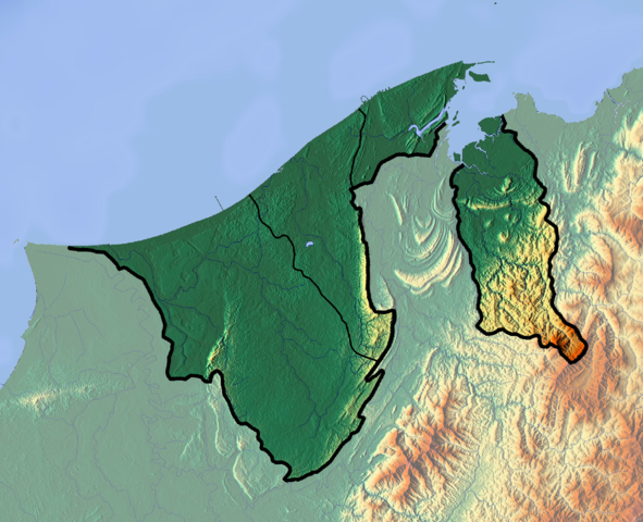
Deutsch: Positionskarte von Brunei
Quadratische Plattkarte. Geographische Begrenzung der Karte:
English: Location map of Brunei
Equirectangular projection. Geographic limits of the map:
|
| Date | |
| Source |
Own work
|
| Author | Dr Brains |
Licensing
I, the copyright holder of this work, hereby publish it under the following licenses:

|
Permission is granted to copy, distribute and/or modify this document under the terms of the GNU Free Documentation License, Version 1.2 only as published by the Free Software Foundation; with no Invariant Sections, no Front-Cover Texts, and no Back-Cover Texts. A copy of the license is included in the section entitled GNU Free Documentation License. | 1.2 only |
|
|
Permission is granted to copy, distribute and/or modify this document under the terms of the GNU Free Documentation License, Version 1.3 or any later version published by the Free Software Foundation; with no Invariant Sections, no Front-Cover Texts, and no Back-Cover Texts. A copy of the license is included in the section entitled GNU Free Documentation License.
|
You may select the license of your choice.
File history
Click on a date/time to view the file as it appeared at that time.
| Date/Time | Thumbnail | Dimensions | User | Comment | |
|---|---|---|---|---|---|
| current | 11:22, 10 June 2012 | | 2,331 × 1,892 (5.92 MB) | Dr Brains |
File usage
The following pages on the English Wikipedia use this file (pages on other projects are not listed):
- Aberdeen Brunei Senior Masters
- Ash-Shaliheen Mosque
- Bandar Seri Begawan
- Batu Apoi Forest Reserve
- Benutan Dam
- Brunei
- Brunei Bay
- Brunei Open
- Geography of Brunei
- Hassanal Bolkiah Mosque
- Hassanal Bolkiah Mosque, Mentiri
- Jerudong Park
- Jerudong Park Amphitheater
- Kedayan River
- Kianggeh River
- Lalak Lake
- Pagon Hill
- Pehin Khatib Abdullah Mosque
- Retak Hill
- Saeh Hill
- Serasa Bay
- Seria oil field
- Tasek Merimbun
- Teraja Waterfall
- Tudal Hill
- Ulu Temburong National Park
- Ulu Tutong Dam
- Module:Location map/data/Brunei
- Module:Location map/data/Brunei/doc
Global file usage
The following other wikis use this file:
- Usage on ar.wikipedia.org
- Usage on ast.wikipedia.org
- Usage on bcl.wikipedia.org
- Usage on bn.wikipedia.org
- Usage on bs.wikipedia.org
- Usage on ceb.wikipedia.org
- Usage on ce.wikipedia.org
- Usage on cs.wikipedia.org
- Usage on el.wikipedia.org
- Usage on fa.wikipedia.org
- Usage on fr.wikipedia.org
- Usage on gl.wikipedia.org
- Usage on he.wikivoyage.org
- Usage on hr.wikipedia.org
- Usage on id.wikipedia.org
- Usage on ilo.wikipedia.org
- Usage on ja.wikipedia.org
- Usage on kaa.wikipedia.org
- Usage on km.wikipedia.org
- Usage on kn.wikipedia.org
- Usage on ko.wikipedia.org
- Usage on ku.wikipedia.org
- Usage on lt.wikipedia.org
View more global usage of this file.