.png)
.png&action=edit&redlink=1)

Size of this preview: 736 × 599 pixels. Other resolutions: 295 × 240 pixels | 590 × 480 pixels | 943 × 768 pixels | 1,258 × 1,024 pixels | 2,515 × 2,048 pixels | 3,283 × 2,673 pixels.
Original file (3,283 × 2,673 pixels, file size: 1,022 KB, MIME type: image/png)
| This is a file from the Wikimedia Commons. Information from its description page there is shown below. Commons is a freely licensed media file repository. You can help. |
.png)

|
This locator map image could be re-created using vector graphics as an SVG file. This has several advantages; see Commons:Media for cleanup for more information. If an SVG form of this image is available, please upload it and afterwards replace this template with
{{vector version available|new image name}}.
It is recommended to name the SVG file “Bitlis Vilayet in Ottoman Empire (1900).svg”—then the template Vector version available (or Vva) does not need the new image name parameter. |
Summary
| Description |
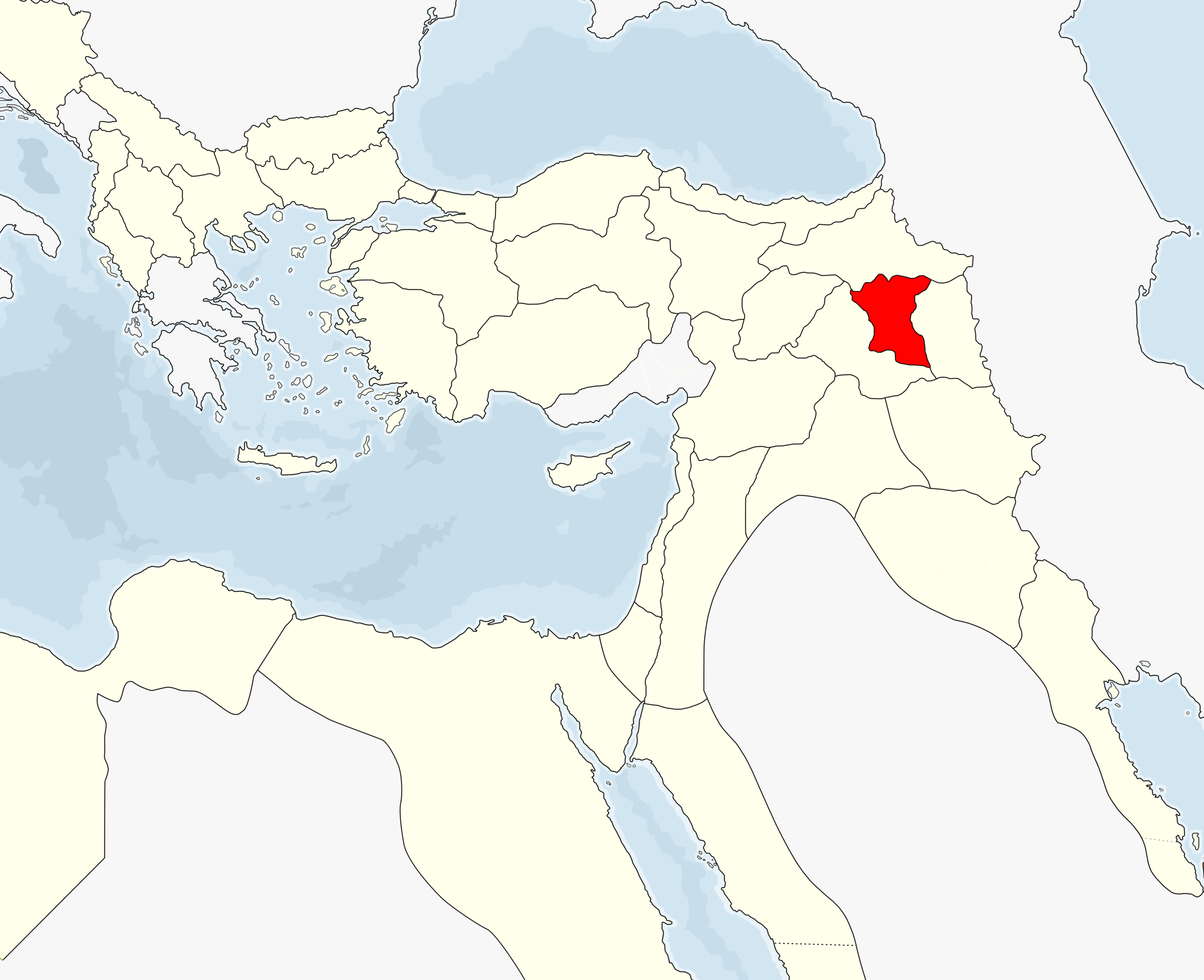
English: Bitlis Vilayet, 1900
According to the information of this map: [1] |
| Date | |
| Source | Own work |
| Author | Underlying lk |
Licensing
I, the copyright holder of this work, hereby publish it under the following licenses:
This file is licensed under the Creative Commons Attribution-Share Alike 3.0 Unported license.
- You are free:
- to share – to copy, distribute and transmit the work
- to remix – to adapt the work
- Under the following conditions:
- attribution – You must give appropriate credit, provide a link to the license, and indicate if changes were made. You may do so in any reasonable manner, but not in any way that suggests the licensor endorses you or your use.
- share alike – If you remix, transform, or build upon the material, you must distribute your contributions under the same or compatible license as the original.

|
Permission is granted to copy, distribute and/or modify this document under the terms of the GNU Free Documentation License, Version 1.2 or any later version published by the Free Software Foundation; with no Invariant Sections, no Front-Cover Texts, and no Back-Cover Texts. A copy of the license is included in the section entitled GNU Free Documentation License. |
You may select the license of your choice.
File history
Click on a date/time to view the file as it appeared at that time.
| Date/Time | Thumbnail | Dimensions | User | Comment | |
|---|---|---|---|---|---|
| current | 12:02, 24 October 2021 | | 3,283 × 2,673 (1,022 KB) | SAİT71 | Updated |
| 21:22, 29 August 2011 |  | 800 × 552 (140 KB) | Underlying lk | rem. corfu | |
| 21:16, 29 August 2011 |  | 800 × 552 (141 KB) | Underlying lk | wider borders | |
| 02:22, 25 August 2011 |  | 1,200 × 977 (202 KB) | Underlying lk | nv | |
| 23:03, 23 August 2011 |  | 1,200 × 977 (73 KB) | Underlying lk | {{Information |Description ={{en|1=Bitlis Vilayet, 1900 According to the information of this map: [http://www.euratlas.net/history/europe/1900/1900_Southeast.html]}} |Source ={{own}} |Author =Underlying lk |Date |
File usage
The following pages on the English Wikipedia use this file (pages on other projects are not listed):
Global file usage
The following other wikis use this file:
- Usage on ar.wikipedia.org
- Usage on de.wikipedia.org
- Usage on el.wikipedia.org
- Usage on es.wikipedia.org
- Usage on fr.wikipedia.org
- Usage on id.wikipedia.org
- Usage on ka.wikipedia.org
- Usage on lv.wikipedia.org
- Usage on ru.wikipedia.org
- Usage on tr.wikipedia.org
- Usage on uk.wikipedia.org
.png)