
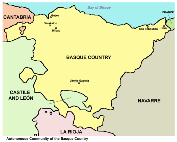
Size of this preview: 748 × 599 pixels. Other resolutions: 300 × 240 pixels | 599 × 480 pixels | 895 × 717 pixels.
Original file (895 × 717 pixels, file size: 47 KB, MIME type: image/png)
| This is a file from the Wikimedia Commons. Information from its description page there is shown below. Commons is a freely licensed media file repository. You can help. |
Summary
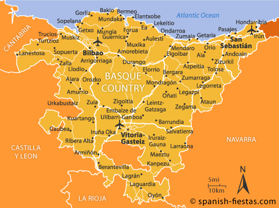
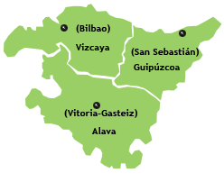
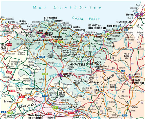
| Description | Map of the Autonomous Community of the Basque Country, Spain. |
| Date | |
| Source | Own work |
| Author | PANONIAN |
Licensing
I, the copyright holder of this work, hereby publish it under the following license:
| This file is made available under the Creative Commons CC0 1.0 Universal Public Domain Dedication. | |
| The person who associated a work with this deed has dedicated the work to the public domain by waiving all of their rights to the work worldwide under copyright law, including all related and neighboring rights, to the extent allowed by law. You can copy, modify, distribute and perform the work, even for commercial purposes, all without asking permission.
|
References
Maps from external links:
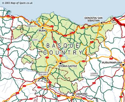
- http://www.mapzones.com/citymap/spain/basque_country/basque_country.jpg
- http://www.map-of-spain.co.uk/maps-of-spain/basque-country/basque400.jpg
- http://mapas.owje.com/img/11861-Mapa-de-carreteras-del-Pais-Vasco.gif
- http://www.zadorspanien.com/picts/Basque_Country_Map.gif[dead link]
- http://www.alwaysonvacation.com/images/US/Basque-Country-Spain-map2.jpg
- http://www.lupain-holiday-rentals.com/map_images/basque-country.jpg
- http://1.bp.blogspot.com/_M5mQhY1RgcI/TGRtl4UfWhI/AAAAAAAAMV8/kCvyvR7t1F8/s1600/Map-Of-Basque-Country.jpg
- http://images.ownersdirect.co.uk/rl450.jpg archive copy at the Wayback Machine
- http://urban.csuohio.edu/~sanda/pic/travel/spain/basque99/basque-regions.jpg archive copy at the Wayback Machine
- http://www.basqueholidays.co.uk/wp-content/uploads/2011/12/pais-vasco-map.jpg[dead link]
- http://www.compareaway.co.uk/images_location/region/Basque%20Country.gif
- http://www.map-of-spain.co.uk/maps-of-spain/basque-country/04-Basque-road-pol-400.gif
- http://www.vayacamping.net/map/e_eus.gif archive copy at the Wayback Machine
- http://www.enerintown.net/Images/mapa%20final.jpg[dead link]
- http://www.regional-climate.eu/uploads/pics/spain_basque_country.gif archive copy at the Wayback Machine
- http://1.bp.blogspot.com/-26XbBwFXZMI/Tz-wjFdWk3I/AAAAAAAABvM/0ZWOzcsBhqE/s1600/vasco-mapa.gif
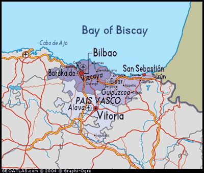
- http://www.red2000.com/spain/images/m-r-pais-vasco.gif
- http://mapas.owje.com/img/Mapa-del-Pais-Vasco-Espana-9823.jpg
- http://www.vacation2spain.com/basque-country.jpg
- http://www.100destinos.com/imagenes/mapa-pais-vasco.gif archive copy at the Wayback Machine
- http://www.touristnetuk.com/spain/basque-country/regionmap.jpg[dead link]
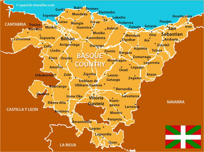
Largest cities and towns in Basque Country:
- http://world-gazetteer.com/wg.php?x=&men=gcis&lng=en&des=gamelan&geo=-72&srt=npan&col=abcdefghinoq&msz=1500&geo=-1304[dead link]
File history
Click on a date/time to view the file as it appeared at that time.
| Date/Time | Thumbnail | Dimensions | User | Comment | |
|---|---|---|---|---|---|
| current | 15:39, 22 July 2012 | | 895 × 717 (47 KB) | PANONIAN | minor correction |
| 16:41, 21 July 2012 |  | 895 × 717 (44 KB) | PANONIAN | {{Information |Description=Map of the Autonomous Community of the Basque Country, Spain. |Source={{own}} |Date=2012 |Author= PANONIAN |Permission= |other_versions= }} |
File usage
The following pages on the English Wikipedia use this file (pages on other projects are not listed):
Global file usage
The following other wikis use this file:
- Usage on af.wikipedia.org
- Usage on als.wikipedia.org
- Usage on an.wikipedia.org
- Usage on arz.wikipedia.org
- Usage on ast.wikipedia.org
- Usage on az.wikipedia.org
- Usage on be-tarask.wikipedia.org
- Usage on be.wikipedia.org
- Usage on bg.wikipedia.org
- Usage on br.wikipedia.org
- Usage on ckb.wikipedia.org
- Usage on cs.wikipedia.org
- Usage on da.wikipedia.org
- Usage on diq.wikipedia.org
- Usage on eo.wikipedia.org
- Usage on es.wikipedia.org
- Usage on ext.wikipedia.org
- Usage on fa.wikipedia.org
- Usage on frp.wikipedia.org
- Usage on fr.wikipedia.org
- Usage on fy.wikipedia.org
- Usage on ga.wikipedia.org
- Usage on hr.wikipedia.org
- Usage on hy.wikipedia.org
- Usage on id.wikipedia.org
- Usage on io.wikipedia.org
- Usage on is.wikipedia.org
- Usage on it.wikipedia.org
- Usage on jv.wikipedia.org
- Usage on ka.wikipedia.org
- Usage on kbd.wikipedia.org
- Usage on kk.wikipedia.org
- Usage on kn.wikipedia.org
- Usage on krc.wikipedia.org
- Usage on kw.wikipedia.org
- Usage on lad.wikipedia.org
- Usage on la.wikipedia.org
- Usage on lt.wikipedia.org
- Usage on mk.wikipedia.org
- Usage on mn.wikipedia.org
- Usage on mr.wikipedia.org
- Usage on ms.wikipedia.org
- Usage on mzn.wikipedia.org
- Usage on nl.wikipedia.org
- Usage on nn.wikipedia.org
- Usage on pl.wikipedia.org
- Usage on pl.wiktionary.org
- Usage on pms.wikipedia.org
- Usage on pnb.wikipedia.org
View more global usage of this file.