File:Avenio vulgo Avignon (Atlas van Loon).jpg

Original file (5,500 × 4,334 pixels, file size: 4.31 MB, MIME type: image/jpeg)

Summary

Author
Pieter Mortier I  (1661–1711)  wikidata:Q7192808
 
Alternative names
Pierre Mortier; Pieter Mortier (I); Pieter Mortier
Description Dutch cartographer, printmaker, publisher, printer, copper engraver and printseller
Date of birth/death 1661 Edit this at Wikidata 1711 Edit this at Wikidata
Location of birth/death Leiden Edit this at Wikidata Amsterdam Edit this at Wikidata
Work location
Paris (1681–1685); Amsterdam (1685–1711) Edit this at Wikidata
Authority file
creator QS:P170,Q7192808
Description
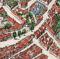
English: Title:Avenio Vulgo Avignon

This plate is from the Atlas Van Loon, which contains two volumes of the French edition of the Willem Blaeu's Atlas Maior, covering France and Switzerland, from 1663.

The Bibliothèque nationale de France (BNF) has an uncoloured version of this engraving: https://catalogue.bnf.fr/ark:/12148/cb40571320g A scan of this copy is available from the Gallica website: https://gallica.bnf.fr/ark:/12148/btv1b53079287p The BNF gives the date as 1690 and the size as 50 x 60 cm.

In the BNF copy, the cartouche at the bottom right containing the scale bar includes the text "A Amsterdam, Pierre Mortier, Avec Privilege". In addition, at the bottom right hand corner of the engraving is the number: "LXXI"

According to the BNF, plate number LXXI is from the second volume of the Nouveau theatre d'Italie ou description exacte de ses villes, palais, églises ... et les cartes géographiques de toutes ses provinces...sur les Desseins de feu Monsieur Jean Blaeu that was published by Pierre Mortier in Amsterdam in 1704.

A copy of an uncoloured versions of this engraving is reproduced as Plate 2 in: Gagnière, S.; Granier, J. (1978). Images du Vieil Avignon (in French). Avignon: Rullière-Libeccio. Plate 2. This copy includes additional text in the cartouche at the bottom right: "A Amsterdam, Pierre Mortier, Avec Privilege, LXXI" (the LXXI is included within the cartouche)

The engraving is a copy of an earlier map in 8 panels dated 1618 in the Bibliothèque Nationale de France (Va 84 Tome 1 H 159061-8). This is not currently available from Gallica. The panels of the 1618 map are reproduced in the 1958 book Évocation du Vieil Avignon by Joseph Girard. The 1618 map gives the authors as Marcus Antonius Gandolfus (Marco Antonio Gandolfo) and Theodorus Hochstraie (Théodore Hoochstraten, an engraver from The Hague) (Girard 1958, pp. 76-77). A low quality image of the 1618 map is available online on page 10 in the document available here. For more information on the 1618 map see: Breton, Alain (1986) "Prix-fait de la gravure du plan de 1618", Annuaire de la Société des amis du Palais des papes et des monuments d'Avignon, pp. 63-64.
Date 1663
date QS:P571,+1663-00-00T00:00:00Z/9
Notes

There are difficulties with the depiction of the Pont Saint-Bénézet. Although less obvious in this picture, the 1618 version shows a partially obscured first pier of the bridge on the river bank (on the Avignon side). The second pier sits in the river and has a cutwater. The chapel is depicted on the third pier but in reality sits on the second pier. There are 23 piers depicted rather than the actual 22. If the partially obscured first pier is ignored then the chapel sits on correct pier but arch 6 is shown as collapsed. In the detailed drawings by the Jesuit architect Étienne Martellange arch 6 is shown as intact but arch 7 collapsed in 1608, 1609 and 1617.

The river to the north of the town is labelled "SORGUE RIVIERE". This is an error - the river is the Rhône. The same error is present on the original 1618 map. (see Girard 1958, p. 78 "une erreur surprenante dans un document si étudié". Girard includes the panels showing La Sorgue between pages 150 and 151)
References Girard, Joseph (1958). Évocation du Vieil Avignon (in French). Paris: Les Éditions de Minuit. OCLC 5391399.
Source/Photographer Atlas van Loon (Atlases from the Maritime Museum of the Scheepvaartmuseum)
Other versions
File:Civitatis Avenionis omnimq 1618 map of Avignon.jpg
The 1618 map from which this map was copied
File:Porte St Lazare on 17th century Avignon map.jpg
Detail showing the Porte Saint-Lazare
File:Portail Magnanen on 17th century Avignon map.jpg
Detail showing the the two gates of the Portail Magnanen

Licensing

This is a faithful photographic reproduction of a two-dimensional, public domain work of art. The work of art itself is in the public domain for the following reason:
Public domain

This work is in the public domain in its country of origin and other countries and areas where the copyright term is the author's life plus 100 years or fewer.


This work is in the public domain in the United States because it was published (or registered with the U.S. Copyright Office) before January 1, 1929.

This file has been identified as being free of known restrictions under copyright law, including all related and neighboring rights.
The official position taken by the Wikimedia Foundation is that "faithful reproductions of two-dimensional public domain works of art are public domain".
This photographic reproduction is therefore also considered to be in the public domain in the United States. In other jurisdictions, re-use of this content may be restricted; see Reuse of PD-Art photographs for details.

Captions

Add a one-line explanation of what this file represents

Items portrayed in this file

depicts

image/jpeg

321f59f045bb37442795c54c8766a09c32d22ac8

4,516,572 byte

4,334 pixel

5,500 pixel

File history

Click on a date/time to view the file as it appeared at that time.

Date/TimeThumbnailDimensionsUserComment
current00:10, 21 December 2008Thumbnail for version as of 00:10, 21 December 20085,500 × 4,334 (4.31 MB)Kweniston{{Information |Description={{en|1=Avignon.}} |Source=Atlas van Loon |Author=unknown |Date=1649 |Permission= |other_versions= }} <!--{{ImageUpload|full}}--> Category:Avignon Category:Atlas van Loon

The following page uses this file:

Global file usage

The following other wikis use this file:

Metadata