Size of this preview: 637 × 599 pixels. Other resolutions: 255 × 240 pixels | 510 × 480 pixels | 816 × 768 pixels | 1,089 × 1,024 pixels | 2,177 × 2,048 pixels | 2,902 × 2,730 pixels.
Original file (2,902 × 2,730 pixels, file size: 4.28 MB, MIME type: image/png)
| This is a file from the Wikimedia Commons. Information from its description page there is shown below. Commons is a freely licensed media file repository. You can help. |
Summary
| Description |
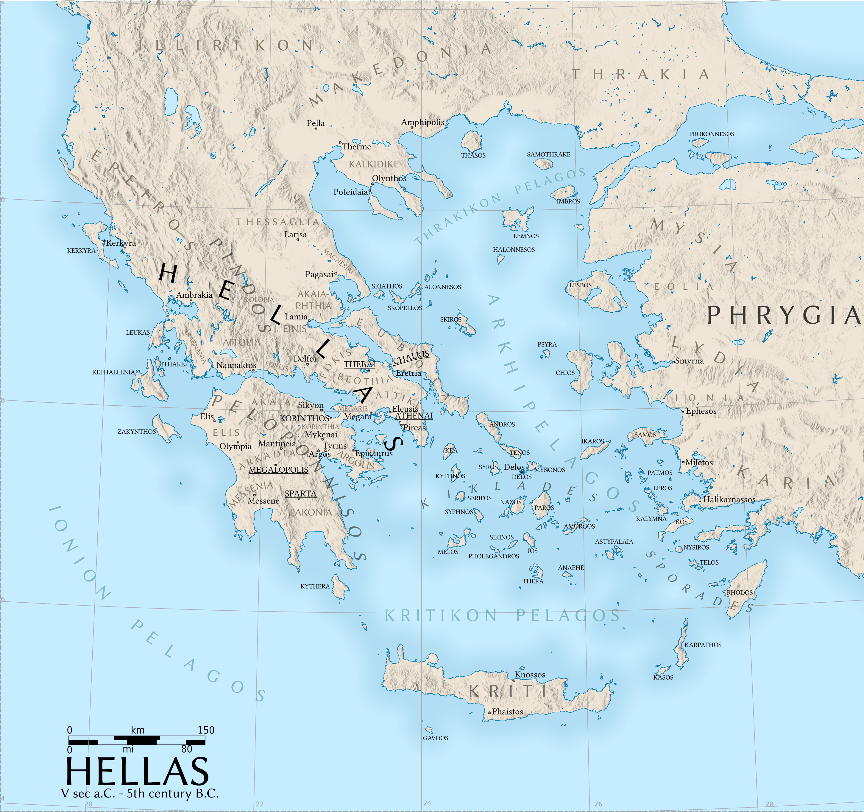
English: Large map of ancient greek poleis, without regions' borders.
Italiano: Una grande mappa delle poleis greche durante il V sec. a.C., senza i confini regionali. |
| Date | |
| Source | Own work |
| Author | Gabriele Zaltron |
Licensing
I, the copyright holder of this work, hereby publish it under the following license:
This file is licensed under the Creative Commons Attribution-Share Alike 4.0 International license.
- You are free:
- to share – to copy, distribute and transmit the work
- to remix – to adapt the work
- Under the following conditions:
- attribution – You must give appropriate credit, provide a link to the license, and indicate if changes were made. You may do so in any reasonable manner, but not in any way that suggests the licensor endorses you or your use.
- share alike – If you remix, transform, or build upon the material, you must distribute your contributions under the same or compatible license as the original.
File history
Click on a date/time to view the file as it appeared at that time.
| Date/Time | Thumbnail | Dimensions | User | Comment | |
|---|---|---|---|---|---|
| current | 19:25, 8 April 2020 | | 2,902 × 2,730 (4.28 MB) | Gabribibbo | Better physical view, thanks to the map of Fut. Perf., taken from https://commons.wikimedia.org/wiki/File:Greece_large_topographic_blank_map.svg |
| 18:47, 8 April 2020 |  | 3,000 × 2,791 (2.66 MB) | Gabribibbo | Uploaded own work with UploadWizard |
File usage
The following pages on the English Wikipedia use this file (pages on other projects are not listed):
Global file usage
The following other wikis use this file:
- Usage on fr.wikipedia.org
- Usage on he.wikipedia.org