
Size of this preview: 497 × 600 pixels. Other resolutions: 199 × 240 pixels | 398 × 480 pixels | 746 × 900 pixels.
Original file (746 × 900 pixels, file size: 123 KB, MIME type: image/jpeg)
| This is a file from the Wikimedia Commons. Information from its description page there is shown below. Commons is a freely licensed media file repository. You can help. |
Summary
| Description |
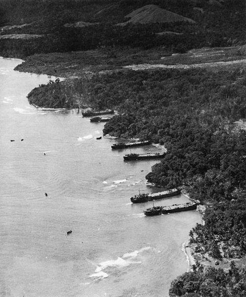
English: Aerial view of shoreline of Saidor, New Guinea, showing LSTs unloading equipment on 2 January 1944. |
| Date | |
| Source | http://www.32nd-division.org/history/ww2/saidor/saidor2.jpg |
| Author | United States Army Signal Corps |
Saidor, New Guinea
Licensing
This file is a work of a U.S. Army soldier or employee, taken or made as part of that person's official duties. As a work of the U.S. federal government, it is in the public domain in the United States.
|
 |
File history
Click on a date/time to view the file as it appeared at that time.
| Date/Time | Thumbnail | Dimensions | User | Comment | |
|---|---|---|---|---|---|
| current | 23:58, 21 November 2015 | | 746 × 900 (123 KB) | Hawkeye7 | User created page with UploadWizard |
File usage
The following pages on the English Wikipedia use this file (pages on other projects are not listed):
Global file usage
The following other wikis use this file:
- Usage on es.wikipedia.org