Size of this preview: 800 × 531 pixels. Other resolutions: 320 × 212 pixels | 640 × 425 pixels | 1,024 × 679 pixels | 1,536 × 1,019 pixels.
Original file (1,536 × 1,019 pixels, file size: 886 KB, MIME type: image/jpeg)
| This is a file from the Wikimedia Commons. Information from its description page there is shown below. Commons is a freely licensed media file repository. You can help. |
Summary
| Description |
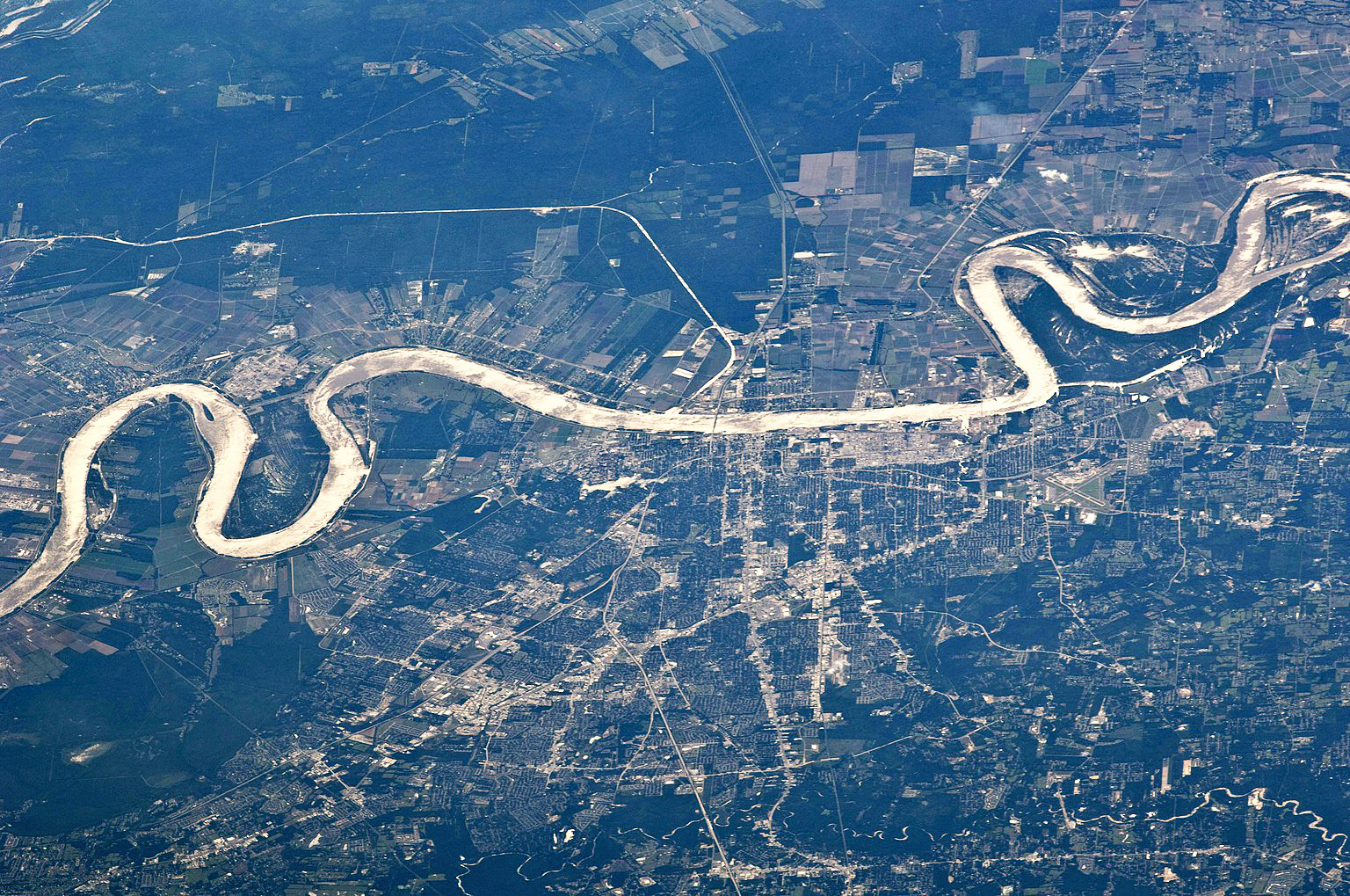
English: Aerial image of Baton Rouge, LA along the Mississippi River from the International Space Station. Downtown Baton Rouge is along the straight segment of the river in the center of the photograph; if you look closely, you can see where Interstate 10 crosses the river at the Horace Wilkinson Bridge. Note that the image is looking to the west, with the right side being north. |
| Date | |
| Source | http://eol.jsc.nasa.gov/scripts/sseop/photo.pl?mission=ISS027&roll=E&frame=33269 |
| Author | NASA Astronaut |
Licensing
This file is in the public domain in the United States because it was created by the Image Science & Analysis Laboratory, of the NASA Johnson Space Center. NASA copyright policy states that "NASA material is not protected by copyright unless noted". (NASA media use guidelines or Conditions of Use of Astronaut Photographs).
Photo source: ISS027-E-33269.
|
File history
Click on a date/time to view the file as it appeared at that time.
| Date/Time | Thumbnail | Dimensions | User | Comment | |
|---|---|---|---|---|---|
| current | 22:22, 19 January 2023 | | 1,536 × 1,019 (886 KB) | Bubba73 | remove some haze, increase contrast |
| 20:13, 3 July 2022 |  | 4,288 × 2,845 (1.71 MB) | 0m9Ep | Brightness, color, crop | |
| 01:42, 24 October 2016 |  | 4,288 × 2,929 (1.35 MB) | WClarke | User created page with UploadWizard |
File usage
The following pages on the English Wikipedia use this file (pages on other projects are not listed):