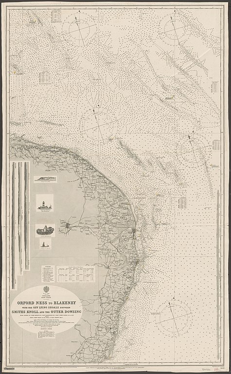
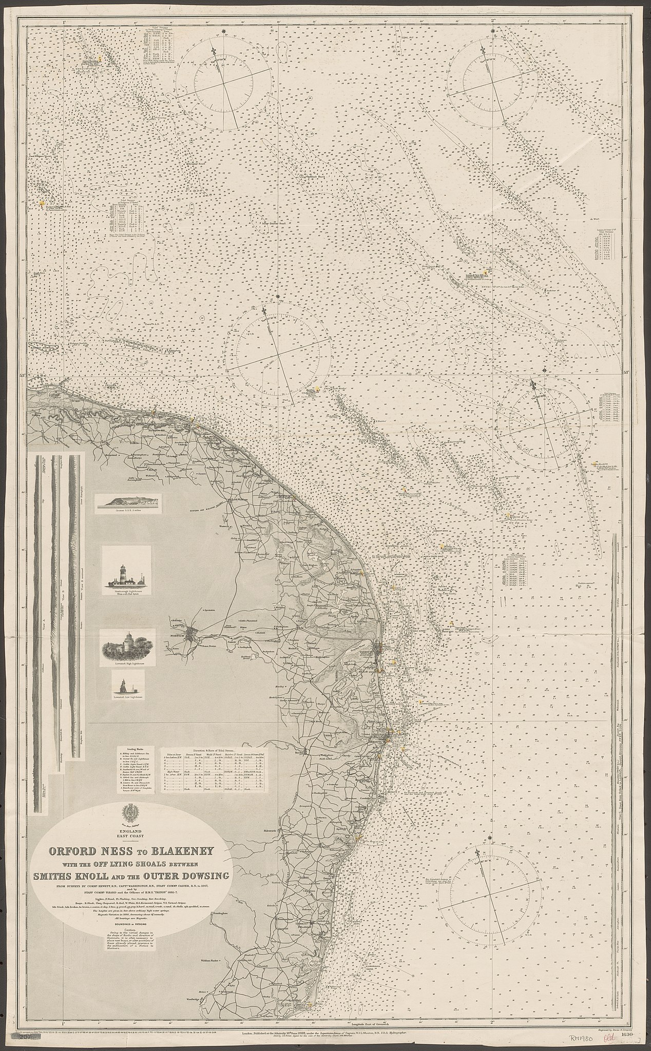
File:Admiralty Chart No 1630 England East Coast. Orford Ness to Blakeney with the off lying shoals between Smith's Knoll and the outer Dowsing, Published 1888.jpg

Size of this preview: 371 × 599 pixels. Other resolutions: 148 × 240 pixels | 297 × 480 pixels | 475 × 768 pixels | 634 × 1,024 pixels | 1,268 × 2,048 pixels | 6,178 × 9,979 pixels.
Original file (6,178 × 9,979 pixels, file size: 24.6 MB, MIME type: image/jpeg)
| This is a file from the Wikimedia Commons. Information from its description page there is shown below. Commons is a freely licensed media file repository. You can help. |
Summary
| Description |
English: Nautical chart of the east coast of England from Orford Ness to Blakeney with the off lying shoals between Smith's Knoll and the outer Dowsing. From surveys by Commr. Hewett, R.N. ; Captn. Washington, R.N. ; Staff Commr. Calver, R.N., to 1867 ; and by Staff Commr. Tizard and the Officers of H.M.S. "Triton" 1885-7. Not current - not to be used for navigation! |
||||||||||
| Date | |||||||||||
| Source | https://nla.gov.au/nla.obj-231681720 | ||||||||||
| Creator |
|
||||||||||
| Geotemporal data | |||||||||||
| Bounding box |
|
||||||||||
| Georeferencing | If inappropriate please set warp_status = skip to hide. | ||||||||||
| Other versions | |||||||||||

Licensing
This work created by the United Kingdom Government is in the public domain.
This is because it is one of the following:
HMSO has declared that the expiry of Crown Copyrights applies worldwide (ref: HMSO Email Reply)
|
 |
File history
Click on a date/time to view the file as it appeared at that time.
| Date/Time | Thumbnail | Dimensions | User | Comment | |
|---|---|---|---|---|---|
| current | 16:22, 5 April 2020 | | 6,178 × 9,979 (24.6 MB) | Kognos | Uploaded a work by W.J.L. Wharton from https://nla.gov.au/nla.obj-231681720 with UploadWizard |
File usage
No pages on the English Wikipedia use this file (pages on other projects are not listed).