File:A map of the Eastern boundary of France to illustrate Article III in The First Peace of Paris 30th May 1814.jpg
Size of this preview: 752 × 600 pixels. Other resolutions: 301 × 240 pixels | 602 × 480 pixels | 963 × 768 pixels | 1,280 × 1,021 pixels | 2,091 × 1,668 pixels.
Original file (2,091 × 1,668 pixels, file size: 1.87 MB, MIME type: image/jpeg)
| This is a file from the Wikimedia Commons. Information from its description page there is shown below. Commons is a freely licensed media file repository. You can help. |
Summary
| Description |
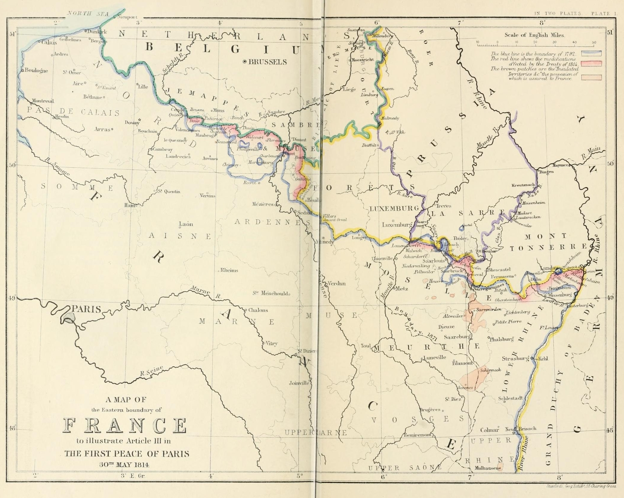
English: A map of the Eastern boundary of France to illustrate Article III in The First Peace of Paris 30th May 1814 |
| Date | |
| Source | Edward Hertslet (1875). The map of Europe by treaty; showing the various political and territorial changes which have taken place since the general peace of 1814, London, Butterworths. p. opposite 28, 351 |
| Author | Edward Hertslet; and Stafford's Geng Estab, 55 Charing Cross |
Licensing
|
This work is in the public domain in its country of origin and other countries and areas where the copyright term is the author's life plus 70 years or fewer. This work is in the public domain in the United States because it was published (or registered with the U.S. Copyright Office) before January 1, 1929. | |
| This file has been identified as being free of known restrictions under copyright law, including all related and neighboring rights. | |
File history
Click on a date/time to view the file as it appeared at that time.
| Date/Time | Thumbnail | Dimensions | User | Comment | |
|---|---|---|---|---|---|
| current | 21:31, 3 September 2014 | | 2,091 × 1,668 (1.87 MB) | PBS | User created page with UploadWizard |
File usage
The following pages on the English Wikipedia use this file (pages on other projects are not listed):
Global file usage
The following other wikis use this file:
- Usage on es.wikipedia.org
- Usage on fr.wikipedia.org
- Usage on he.wikipedia.org
- Usage on it.wikipedia.org
- Usage on ja.wikipedia.org
- Usage on pnb.wikipedia.org
- Usage on sl.wikipedia.org
- Usage on sr.wikipedia.org
- Usage on sv.wikipedia.org
- Usage on tt.wikipedia.org
- Usage on ur.wikipedia.org