
Size of this preview: 397 × 599 pixels. Other resolutions: 159 × 240 pixels | 318 × 480 pixels | 509 × 768 pixels | 679 × 1,024 pixels | 2,351 × 3,547 pixels.
Original file (2,351 × 3,547 pixels, file size: 4.88 MB, MIME type: image/jpeg)
| This is a file from the Wikimedia Commons. Information from its description page there is shown below. Commons is a freely licensed media file repository. You can help. |
Summary
| Description |
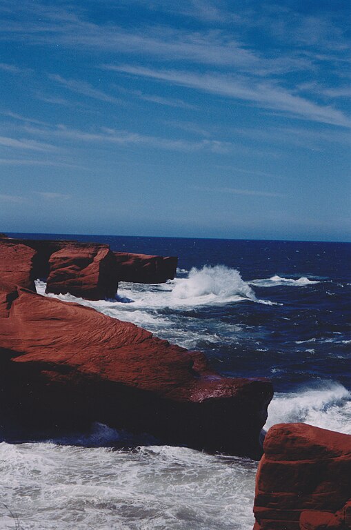
English: 47° 23' 00" N - 61° 52' 00" W, Les Îles-de-la-Madeleine, Gulf of St. Lawrence, Cap aux Meules Island, Les Îles-de-la-Madeleine (Municipality) (L'Étang-du-Nord), Lighthouse Road, between L'Étang-du-Nord and Fatima, day of sea, storm tail, winds and rough seas, Sunday, June 16, 1996
Français : 47° 23' 00" N - 61° 52' 00" O, Les Îles-de-la-Madeleine, golfe Saint-Laurent, île de Cap aux Meules, Les Îles-de-la-Madeleine (Municipalité) (L'Étang-du-Nord), chemin du Phare, entre l'Étang-du-Nord et Fatima, jour de mer, de queue de tempête, de vents et de mer agitée, le dimanche 16 juin 1996 |
| Date | |
| Source | Own work |
| Author | Nichole Ouellette |
- Magdalen Island Rochers aux Oiseaux (Bird Rocks)
- Old Harry, Grosse île
- Refuge faunique de la Pointe-de-l'Est
- Vaccinium macrocarpon Aiton. — Airelle à gros fruits. — Gros atocas ; aux îles de la Madeleine : Graines, Pommes de pré. — (Large Cranberry)
- Sarracenia purpurea Linné. — Sarracénie pourpre. — Petits cochons, Herbe-crapaud. — (Pitcher-plant).
Licensing
I, the copyright holder of this work, hereby publish it under the following license:
This file is licensed under the Creative Commons Attribution 4.0 International license.
- You are free:
- to share – to copy, distribute and transmit the work
- to remix – to adapt the work
- Under the following conditions:
- attribution – You must give appropriate credit, provide a link to the license, and indicate if changes were made. You may do so in any reasonable manner, but not in any way that suggests the licensor endorses you or your use.
File history
Click on a date/time to view the file as it appeared at that time.
| Date/Time | Thumbnail | Dimensions | User | Comment | |
|---|---|---|---|---|---|
| current | 05:44, 4 March 2024 | | 2,351 × 3,547 (4.88 MB) | Nichole Ouellette | Uploaded own work with UploadWizard |
File usage
The following pages on the English Wikipedia use this file (pages on other projects are not listed):