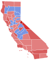
Size of this PNG preview of this SVG file: 600 × 600 pixels. Other resolutions: 240 × 240 pixels | 480 × 480 pixels | 768 × 768 pixels | 1,024 × 1,024 pixels | 2,048 × 2,048 pixels | 794 × 794 pixels.
Original file (SVG file, nominally 794 × 794 pixels, file size: 601 KB)
File history
Click on a date/time to view the file as it appeared at that time.
| Date/Time | Thumbnail | Dimensions | User | Comment | |
|---|---|---|---|---|---|
| current | 16:38, 25 August 2024 |  | 794 × 794 (601 KB) | ZackCarns | Map with Marin County included |
| 04:11, 1 March 2023 |  | 744 × 744 (596 KB) | Putitonamap98 | shapes | |
| 14:00, 30 May 2022 |  | 621 × 733 (41 KB) | Dmsu | Fix San Francisco | |
| 21:50, 29 September 2018 |  | 621 × 733 (41 KB) | Kingofthedead | shade | |
| 01:24, 10 April 2010 |  | 621 × 733 (253 KB) | Kurykh | {{Information |Description= Election results by county |Source={{own}} |Date= 2010-04-09 |Author= Kurykh |Permission= |other_versions= }} Category:Electoral maps of California Category:California gubernatorial election maps |
File usage
The following page uses this file:
