File:1879 Portland & Ogdensburg map only.jpg

Original file(2,995 × 2,004 pixels, file size: 1.65 MB, MIME type: image/jpeg)

Description
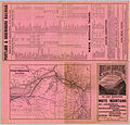
English: 1879 map of the Portland and Ogdensburg Rail Road
Date
Source David Rumsey Map Collection
Author Rand Avery & Co., publisher
Permission
(Reusing this file)
Public domain
This work is in the public domain in the United States because it was published (or registered with the U.S. Copyright Office) before January 1, 1929.

Public domain works must be out of copyright in both the United States and in the source country of the work in order to be hosted on the Commons. If the work is not a U.S. work, the file must have an additional copyright tag indicating the copyright status in the source country.
Note: This tag should not be used for sound recordings.PD-1923Public domain in the United States//commons.wikimedia.org/wiki/File:1879_Portland_%26_Ogdensburg_map_only.jpg
Other versions

Captions

Add a one-line explanation of what this file represents

Items portrayed in this file

depicts

26 July 1879Gregorian

image/jpeg

5b4f5465321e5f3ee33e6f6cd85a566c010a5483

1,731,710 byte

2,004 pixel

2,995 pixel

File history

Click on a date/time to view the file as it appeared at that time.

Date/TimeThumbnailDimensionsUserComment
current14:29, 26 July 2005Thumbnail for version as of 14:29, 26 July 20052,995 × 2,004 (1.65 MB)SPUI~commonswiki{{PD}} 1879 map of the Portland and Ogdensburg Railroad from [http://www.davidrumsey.com/ davidrumsey.com]. See also Image:1879 Portland & Ogdensburg.jpg and Image:1879 Portland & Ogdensburg White Mountains.jpg. [[category:Maine Central Railroad
The following pages on the English Wikipedia use this file (pages on other projects are not listed):

Metadata