Size of this preview: 500 × 599 pixels. Other resolutions: 200 × 240 pixels | 401 × 480 pixels | 824 × 987 pixels.
Original file (824 × 987 pixels, file size: 1.94 MB, MIME type: image/png)
| This is a file from the Wikimedia Commons. Information from its description page there is shown below. Commons is a freely licensed media file repository. You can help. |
Summary
| Description |
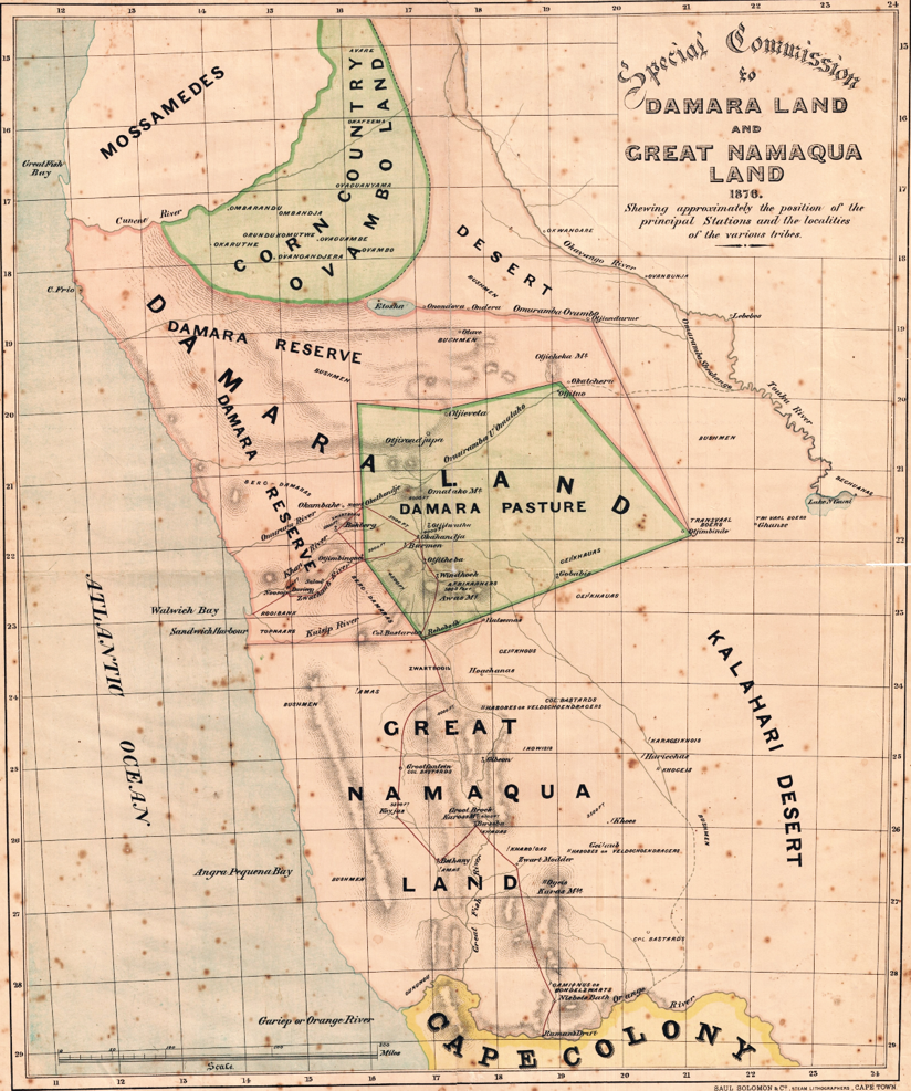
English: Map of WC Palgrave Commission to report on the people and states of Damaraland and Namaqualand and inform decision on merging Government of Cape of Good Hope with states of South West Africa. |
| Date | |
| Source | Cape Archives - Palgrave papers |
| Author | WC Palgrave (1876). Lithographed by Saul Solomon & Co. |
Licensing
|
This work is in the public domain in its country of origin and other countries and areas where the copyright term is the author's life plus 70 years or fewer. This work is in the public domain in the United States because it was published (or registered with the U.S. Copyright Office) before January 1, 1929. | |
| This file has been identified as being free of known restrictions under copyright law, including all related and neighboring rights. | |
File history
Click on a date/time to view the file as it appeared at that time.
| Date/Time | Thumbnail | Dimensions | User | Comment | |
|---|---|---|---|---|---|
| current | 16:12, 18 July 2017 | | 824 × 987 (1.94 MB) | Abu Shawka | User created page with UploadWizard |
File usage
The following pages on the English Wikipedia use this file (pages on other projects are not listed):
Global file usage
The following other wikis use this file:
- Usage on als.wikipedia.org