Size of this preview: 800 × 494 pixels. Other resolutions: 320 × 198 pixels | 640 × 395 pixels | 1,024 × 633 pixels | 1,280 × 791 pixels | 2,560 × 1,582 pixels | 3,413 × 2,109 pixels.
Original file (3,413 × 2,109 pixels, file size: 3.35 MB, MIME type: image/jpeg)
| This is a file from the Wikimedia Commons. Information from its description page there is shown below. Commons is a freely licensed media file repository. You can help. |
Summary
| Description |
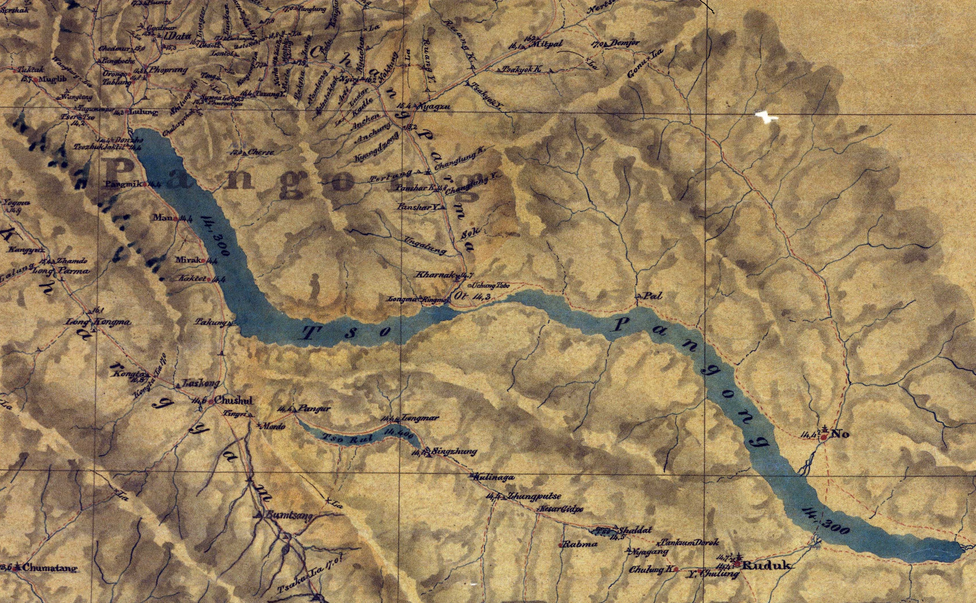
English: This is the first detail map of Pangong Lake area |
| Date | |
| Source | https://pahar.in/indian-subcontinent-pre-1899/ |
| Author | Sir Henry Strachey (1816-1912) |
| Other versions |

Licensing
|
This work is in the public domain in its country of origin and other countries and areas where the copyright term is the author's life plus 70 years or fewer. This work is in the public domain in the United States because it was published (or registered with the U.S. Copyright Office) before January 1, 1929. | |
| This file has been identified as being free of known restrictions under copyright law, including all related and neighboring rights. | |
File history
Click on a date/time to view the file as it appeared at that time.
| Date/Time | Thumbnail | Dimensions | User | Comment | |
|---|---|---|---|---|---|
| current | 22:25, 28 June 2020 | | 3,413 × 2,109 (3.35 MB) | Kautilya3 | Uploaded a work by Sir Henry Strachey (1816-1912) from https://pahar.in/indian-subcontinent-pre-1899/ with UploadWizard |
File usage
The following pages on the English Wikipedia use this file (pages on other projects are not listed):
Global file usage
The following other wikis use this file:
- Usage on ml.wikipedia.org