Size of this preview: 800 × 483 pixels. Other resolutions: 320 × 193 pixels | 640 × 386 pixels | 1,024 × 618 pixels | 1,280 × 773 pixels | 2,560 × 1,545 pixels | 6,104 × 3,684 pixels.
Original file (6,104 × 3,684 pixels, file size: 4.27 MB, MIME type: image/jpeg)
| This is a file from the Wikimedia Commons. Information from its description page there is shown below. Commons is a freely licensed media file repository. You can help. |
Summary
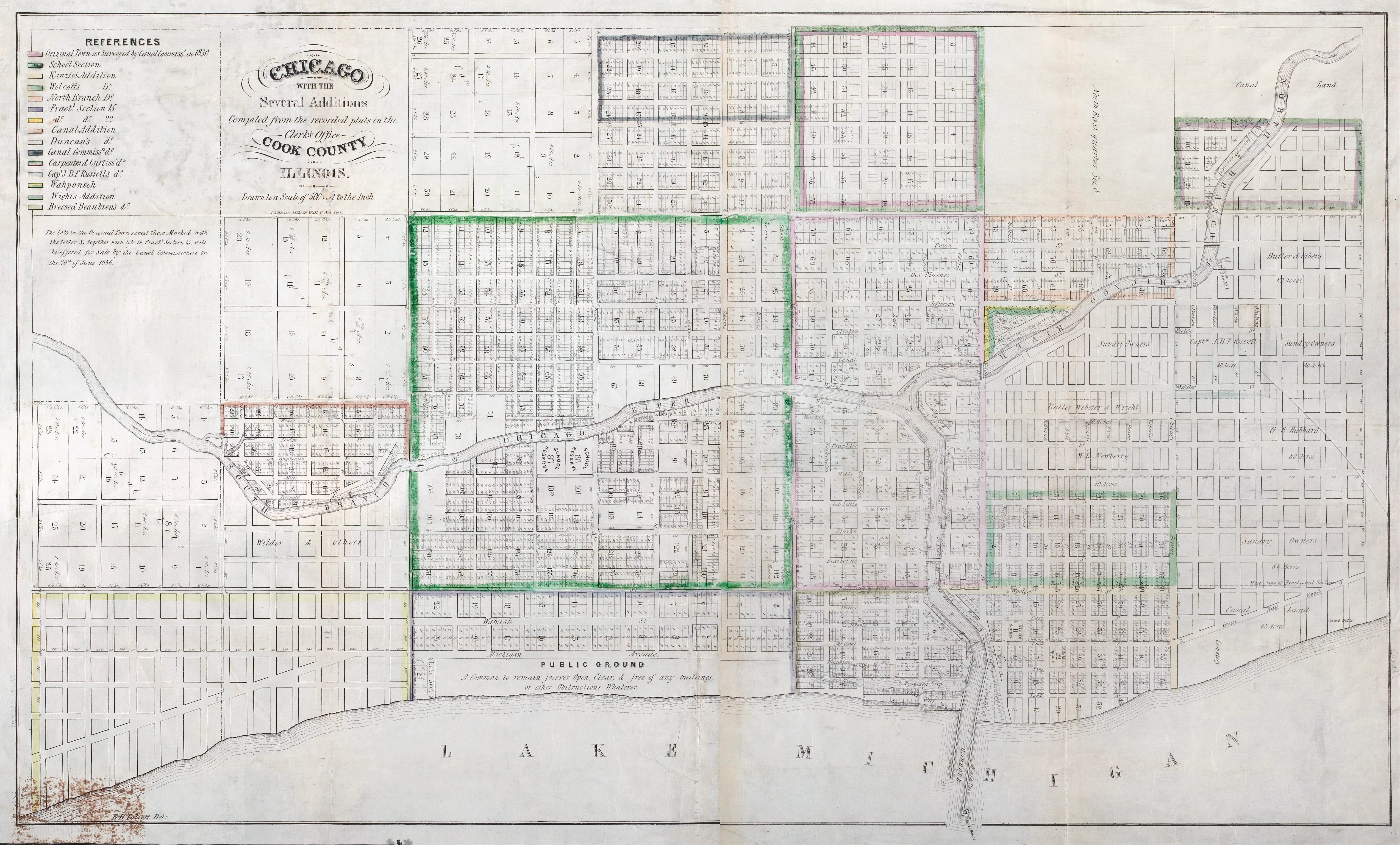
| Title |
Map of Chicago Created by the Illinois and Michigan Canal commissioners and recorded on July 2, 1836 |
| Description |
English: 1836 map of Chicago with Additions |
| Date | |
| Source | Chicago Historical Society |
| Creator |
E.B. Talcott, resident engineer, Illinois and Michigan Canal; T.A. Mesier's Lith, 28 Wall St, New York |
| Geotemporal data | |
| Date depicted | |
| Map location | Chicago |
| Georeferencing | If inappropriate please set warp_status = skip to hide. |
| Archival data | |
| Accession number |
ICHi-37310 |
Licensing
|
This work is in the public domain in its country of origin and other countries and areas where the copyright term is the author's life plus 100 years or fewer. This work is in the public domain in the United States because it was published (or registered with the U.S. Copyright Office) before January 1, 1929. | |
| This file has been identified as being free of known restrictions under copyright law, including all related and neighboring rights. | |
File history
Click on a date/time to view the file as it appeared at that time.
| Date/Time | Thumbnail | Dimensions | User | Comment | |
|---|---|---|---|---|---|
| current | 19:41, 25 February 2016 | | 6,104 × 3,684 (4.27 MB) | Scewing | {{LargeImage}} {{Map |title = Map of Chicago Created by the Illinois and Michigan Canal commissioners and recorded on July 2, 1836 |description = {{en|1836 map of Chicago with Additions}} |legend = |author = E.B.... |
File usage
The following pages on the English Wikipedia use this file (pages on other projects are not listed):