No higher resolution available.
1779_Livingston_Manor_map.png (542 × 413 pixels, file size: 69 KB, MIME type: image/png)
| This is a file from the Wikimedia Commons. Information from its description page there is shown below. Commons is a freely licensed media file repository. You can help. |
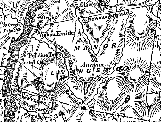
| Description | 1779 map of Livingston Manor and neighboring colonial land grants | ||||
| Date | |||||
| Source | National Historic Landmark application for Hudson River Historic District | ||||
| Author | Unknown author | ||||
| Permission (Reusing this file) |
|
||||
File history
Click on a date/time to view the file as it appeared at that time.
| Date/Time | Thumbnail | Dimensions | User | Comment | |
|---|---|---|---|---|---|
| current | 18:17, 21 November 2007 | | 542 × 413 (69 KB) | Daniel Case | {{Information |Description=1779 map of Livingston Manor and neighboring colonial land grants |Source=[http://pdfhost.focus.nps.gov/docs/NHLS/Text/90002219.pdf National Historic Landmark application] for [[w:Hudson River Historic Dis |
File usage
The following pages on the English Wikipedia use this file (pages on other projects are not listed):