
Size of this preview: 732 × 600 pixels. Other resolutions: 293 × 240 pixels | 586 × 480 pixels | 937 × 768 pixels | 1,250 × 1,024 pixels | 2,499 × 2,048 pixels | 4,989 × 4,088 pixels.
Original file (4,989 × 4,088 pixels, file size: 8.36 MB, MIME type: image/jpeg)
| This is a file from the Wikimedia Commons. Information from its description page there is shown below. Commons is a freely licensed media file repository. You can help. |
Summary
| Description |
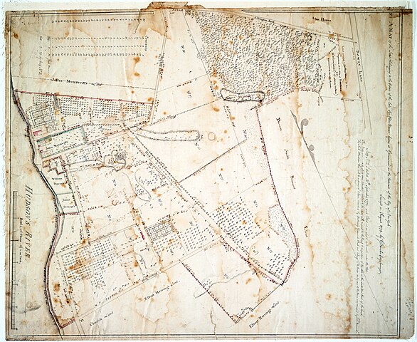
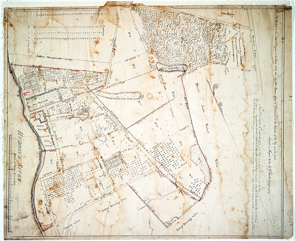
English: Detail showing the Mandeville Farm in 1773 taken from a map by Gerard Bancker called "A map of the lands belonging to the estate of the late Sir Peter Warren lying at Greenwich in the outward of the city of New York" (26 x 10 inches, pen and ink, held by the New York Public Library) |
| Date | |
| Source | New York Public Library |
| Author | Gerard Bancker |
Licensing
This work is in the public domain in the United States because it was published (or registered with the U.S. Copyright Office) before January 1, 1929.
Public domain works must be out of copyright in both the United States and in the source country of the work in order to be hosted on the Commons. If the work is not a U.S. work, the file must have an additional copyright tag indicating the copyright status in the source country.
Note: This tag should not be used for sound recordings. |
File history
Click on a date/time to view the file as it appeared at that time.
| Date/Time | Thumbnail | Dimensions | User | Comment | |
|---|---|---|---|---|---|
| current | 12:41, 21 February 2024 | | 4,989 × 4,088 (8.36 MB) | Delabrede | Uploaded a work by Gerard Bancker from New York Public Library with UploadWizard |
File usage
The following pages on the English Wikipedia use this file (pages on other projects are not listed):