
Size of this preview: 800 × 573 pixels. Other resolutions: 320 × 229 pixels | 640 × 458 pixels | 1,024 × 733 pixels | 1,408 × 1,008 pixels.
Original file (1,408 × 1,008 pixels, file size: 1.37 MB, MIME type: image/jpeg)
| This is a file from the Wikimedia Commons. Information from its description page there is shown below. Commons is a freely licensed media file repository. You can help. |
Summary
| Description |
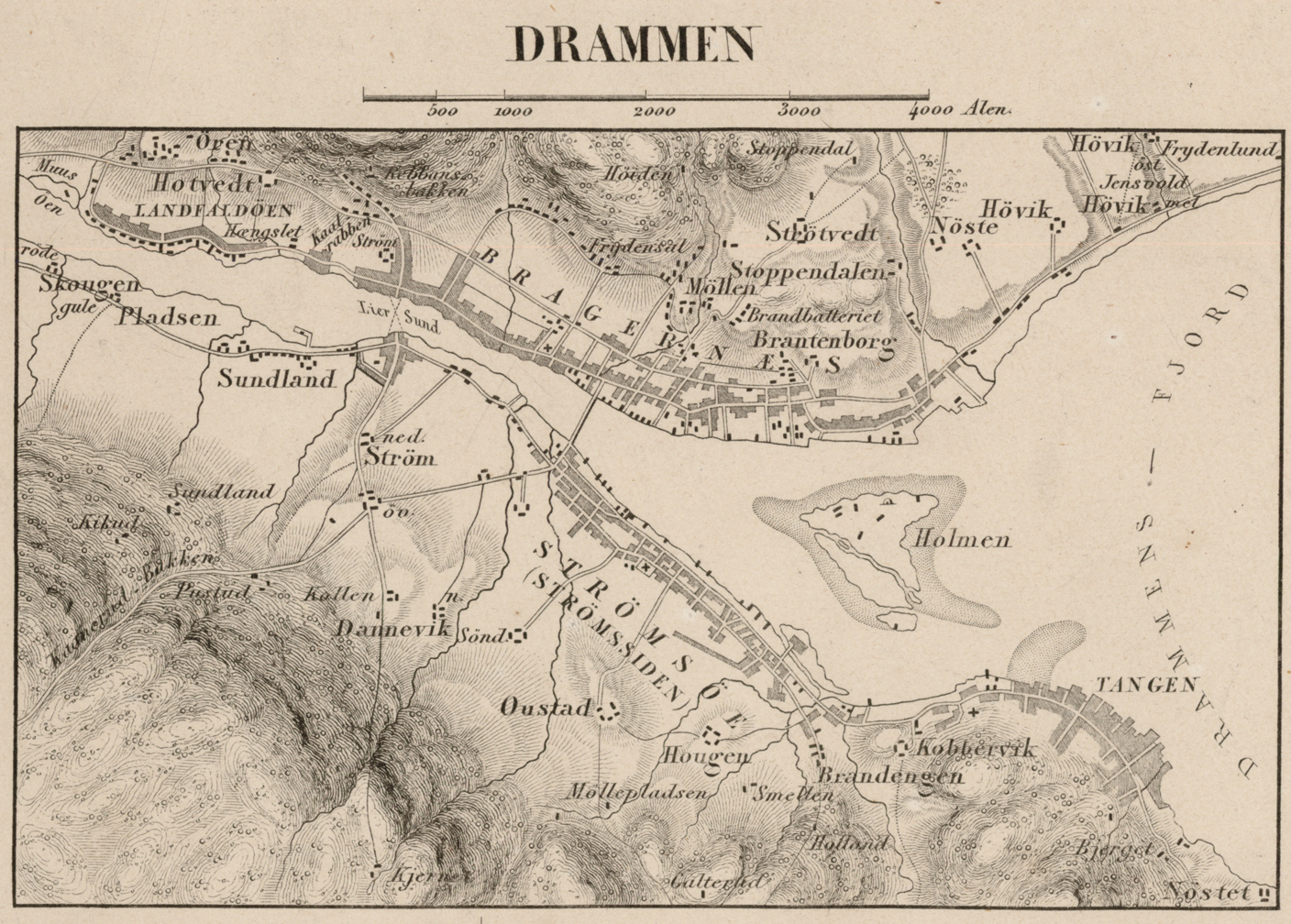
English: Chalcographic map of Drammen, Norway in 1854. By Søren Christian Gjessing.
Norsk bokmål: Kart over Drammen i 1854. Kobberstikk av Søren Christian Gjessing |
| Date | |
| Source | https://kartverket.no/historiske/16/16004_amt2_buskerud-amt-21-soera_1854_jpg300dpi.jpg |
| Author | Kartverket (Norges Geografiske Oppmåling) |
| Camera location | | View this and other nearby images on: OpenStreetMap |
|---|
Licensing
This work is in the public domain in the United States because it was published (or registered with the U.S. Copyright Office) before January 1, 1929.
Public domain works must be out of copyright in both the United States and in the source country of the work in order to be hosted on the Commons. If the work is not a U.S. work, the file must have an additional copyright tag indicating the copyright status in the source country.
Note: This tag should not be used for sound recordings. |
This file is licensed under the Creative Commons Attribution 4.0 International license.
- You are free:
- to share – to copy, distribute and transmit the work
- to remix – to adapt the work
- Under the following conditions:
- attribution – You must give appropriate credit, provide a link to the license, and indicate if changes were made. You may do so in any reasonable manner, but not in any way that suggests the licensor endorses you or your use.
File history
Click on a date/time to view the file as it appeared at that time.
| Date/Time | Thumbnail | Dimensions | User | Comment | |
|---|---|---|---|---|---|
| current | 08:18, 4 May 2021 | | 1,408 × 1,008 (1.37 MB) | Cashewnøtt | Uploaded a work by Kartverket (Norges Geografiske Oppmåling) from https://kartverket.no/historiske/16/16004_amt2_buskerud-amt-21-soera_1854_jpg300dpi.jpg with UploadWizard |
File usage
The following pages on the English Wikipedia use this file (pages on other projects are not listed):
Global file usage
The following other wikis use this file:
- Usage on no.wikipedia.org