Size of this preview: 620 × 599 pixels. Other resolutions: 248 × 240 pixels | 497 × 480 pixels | 794 × 768 pixels | 1,059 × 1,024 pixels | 2,287 × 2,211 pixels.
Original file (2,287 × 2,211 pixels, file size: 1.03 MB, MIME type: image/jpeg)
| This is a file from the Wikimedia Commons. Information from its description page there is shown below. Commons is a freely licensed media file repository. You can help. |
Summary
| Description |
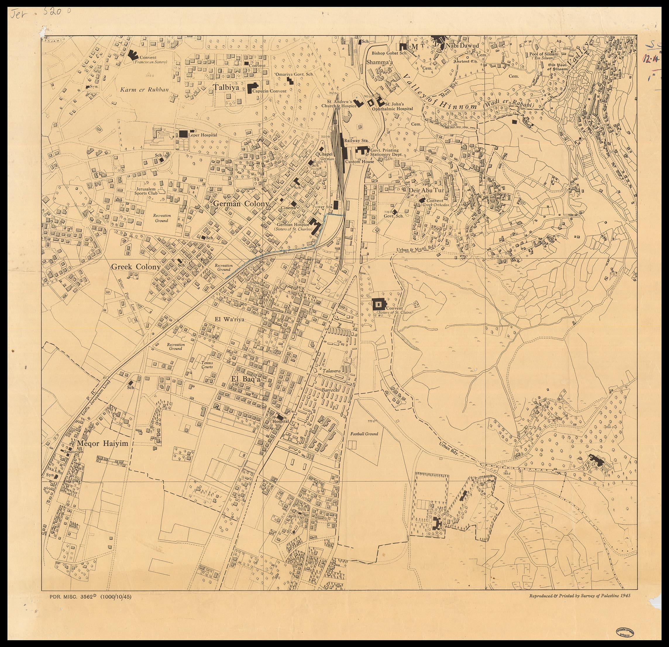
English: A detailed and accurate measurment map of Jerusalem, produced by the Survey of Palestine, 1945. Scale 1:5,000.
עברית: מפת מדידה מדויקת ומפורטת של ירושלים, בקנה מידה 1:5,000 שהוכנה ע"י מחלקת המדידות של ממשלת המנדט, 1945.
Click to enlarge |
|||
| Date | ||||
| Source | The Eran Laor Cartographic Collection, National Library of Israel | |||
| Author | The National Library of Israel | |||
| Other versions |


_-Jerusalem-_Reproduced_%26_printed_by_Survey_of_Palestine-south-east-sheet_(cropped).jpg)
.jpg)
Licensing
|
This work is in the public domain in its country of origin and other countries and areas where the copyright term is the author's life plus 70 years or fewer. | |
| This file has been identified as being free of known restrictions under copyright law, including all related and neighboring rights. | |
File history
Click on a date/time to view the file as it appeared at that time.
| Date/Time | Thumbnail | Dimensions | User | Comment | |
|---|---|---|---|---|---|
| current | 13:06, 12 December 2015 | | 2,287 × 2,211 (1.03 MB) | National Library of Israel |
File usage
The following pages on the English Wikipedia use this file (pages on other projects are not listed):
Global file usage
The following other wikis use this file:
- Usage on ar.wikipedia.org
- Usage on de.wikipedia.org
- Usage on es.wikipedia.org
- Usage on fa.wikipedia.org