
Size of this preview: 800 × 600 pixels. Other resolutions: 320 × 240 pixels | 640 × 480 pixels | 1,024 × 768 pixels | 1,280 × 960 pixels | 2,592 × 1,944 pixels.
Original file (2,592 × 1,944 pixels, file size: 4.49 MB, MIME type: image/jpeg)
| This is a file from the Wikimedia Commons. Information from its description page there is shown below. Commons is a freely licensed media file repository. You can help. |
Summary
| Description |
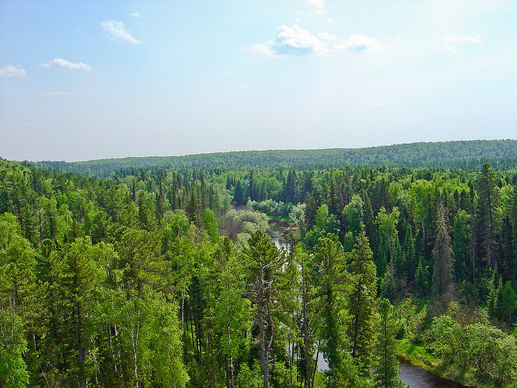
Русский: Снимок р. Негусьях с вертолета. Внизу заповедник Юганский, темнохвойная тайга |
| Source | Own work |
| Author | Lacrus |
| Camera location | | View this and other nearby images on: OpenStreetMap |
|---|
Licensing
| I, the copyright holder of this work, release this work into the public domain. This applies worldwide. In some countries this may not be legally possible; if so: I grant anyone the right to use this work for any purpose, without any conditions, unless such conditions are required by law. |
File history
Click on a date/time to view the file as it appeared at that time.
| Date/Time | Thumbnail | Dimensions | User | Comment | |
|---|---|---|---|---|---|
| current | 09:23, 20 April 2013 | | 2,592 × 1,944 (4.49 MB) | Fährtenleser | change colours, contrast, sharpness a.s.o. |
| 17:40, 5 July 2009 |  | 2,592 × 1,944 (2.05 MB) | Lacrus | {{Information |Description={{ru|1=Снимок р. Негусьях с вертолета. Внизу заповедник Юганский, темнохвойная тайга}} |Source=Own work by uploader |Author=Lacrus |Date= |Permissi |
File usage
The following pages on the English Wikipedia use this file (pages on other projects are not listed):
Global file usage
The following other wikis use this file:
- Usage on arz.wikipedia.org
- Usage on az.wikipedia.org
- Usage on ba.wikipedia.org
- Юган ҡурсаулығы
- Рәсәй ҡурсаулыҡтары исемлеге
- Ҙур Арктика ҡурсаулығы
- Васюган ҡурсаулығы
- Ҡалып:Себер ҡурсаулыҡтары
- Хакас ҡурсаулығы
- Азас (ҡурсаулыҡ)
- Алтай ҡурсаулығы
- Байкал-Лена ҡурсаулығы
- Витим ҡурсаулығы
- Катунь ҡурсаулығы
- Путоран ҡурсаулығы
- Таймыр ҡурсаулығы
- Тигирек ҡурсаулығы
- Тунгус ҡурсаулығы
- Үҙәк Себер ҡурсаулығы
- Үрге Таз ҡурсаулығы
- Гыдан милли паркы
- Usage on be.wikipedia.org
- Usage on ceb.wikipedia.org
- Usage on es.wikipedia.org
- Usage on et.wikipedia.org
- Usage on fr.wikipedia.org
- Usage on hy.wikipedia.org
- Usage on it.wikipedia.org
- Usage on kk.wikipedia.org
- Usage on mk.wikipedia.org
- Usage on nl.wikipedia.org
- Usage on pl.wikipedia.org
- Usage on ru.wikipedia.org
- Прибайкальский национальный парк
- Красноярские Столбы
- Путоранский заповедник
- Список заповедников России
- Темнохвойный лес
- Саяно-Шушенский заповедник
- Байкало-Ленский заповедник
- Витимский заповедник
- Шорский национальный парк
- Алтайский заповедник
- Катунский заповедник
- Хакасский заповедник
- Азас (заповедник)
- Тигирекский заповедник
- Таймырский заповедник
View more global usage of this file.