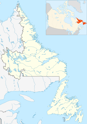
St. Bride's Radar Station was a United States Army General Surveillance Ground Radar Early Warning Station in the Dominion of Newfoundland.[1][2] It was built during World War II and responsible for monitoring air traffic from Naval Station Argentia to RCAF Torbay and into the Atlantic Ocean.[3] It was located in St. Bride's, 135 kilometres (84 mi) southwest of St. John's.[4] It was closed in 1945.
| St. Bride's Radar Station | |
|---|---|
| Part of United States General Surveillance Radar | |
| Newfoundland | |
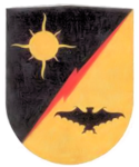
 Emblem of the 685th Air Warning Squadron | |
| Coordinates | 46°55′54.7″N 054°10′49.2″W / 46.931861°N 54.180333°W |
| Type | Radar Station |
| Code | Trio |
| Site information | |
| Controlled by | Newfoundland Base Command |
| Site history | |
| Built | 1942 |
| Built by | United States Army |
| In use | 1943-1945 |
| Garrison information | |
| Garrison | 685th Air Warning Company |
History
editThe site was established in 1942 as a United States Ground Radar Early Warning Station, funded by the United States Army,[5] which stationed the 685th Air Warning Squadron on the site under operational control of Newfoundland Base Command at Pepperrell Air Force Base.[6][7] Fifty-two members (three officers and 49 enlisted men) of the 685th were assigned to St Bride's. It operated an SCR-271 manned early-warning radar with information sent by radio to a plotting center at Pepperrell AFB to track aircraft. St Bride's was the third of a chain of four stations around the Newfoundland coast and was accordingly given the radio code name of "Trio".[8] The station was assigned to Royal Canadian Air Force on 1 November 1944, and was given designation "No 41 RU". The RCAF operated the station until 7 October 1945.
United States Army Air Forces units and assignments
editUnits:
- Inactivated November 1944
Assignments:
- Newfoundland Base Command, Winter 1943
References
edit- ^ Cardoulis, John N (1990). A Friendly Invasion (The American Military in Newfoundland: 1940-1990). St John's: Breakwater Books Ltd. p. 25. ISBN 0-920911-85-4.
- ^ "Searching the Skies, The Legacy of the United States Cold War Defense Radar Program" (PDF).
- ^ Cuff, Robert (1981). Encyclopedia of Newfoundland and Labrador (PDF). St John's: Newfoundland Book Publishers (1967) Ltd. p. 14. ISBN 0920508146.
- ^ "The CADIN Pinetree Line Locations".
- ^ "A Handbook of Aerospace Defense Organization 1946 - 1980" (PDF).
- ^ Group, NBC (1997). A History of the Air Defence of Canada 1948-1997. Washington, DC: Commander Fighter Group. p. 148. ISBN 0-9681973-0-2.
{{cite book}}:|last=has generic name (help) - ^ "Other American Stations". www.heritage.nf.ca.
- ^ Cardoulis (1990) p. 134
This article incorporates public domain material from the Air Force Historical Research Agency
- Cornett, Lloyd H. and Johnson, Mildred W., A Handbook of Aerospace Defense Organization 1946 - 1980,[1] Office of History, Aerospace Defense Center, Peterson AFB, CO (1980)

