Cuyuni-Mazaruni (Region 7) is a region of Guyana. Its capital is Bartica, with villages including Issano, Kartabo, Kamarang, and Imbaimadai.
Cuyuni-Mazaruni
Region 7 | |
|---|---|
Administrative Region | |
 | |
 Flag | |
 Map of Guyana showing Cuyuni-Mazaruni region | |
| Country | |
| Regional Capital | Bartica |
| Area | |
| • Total | 47,213 km2 (18,229 sq mi) |
| Population (2012 census) | |
| • Total | 20,280 |
| • Density | 0.43/km2 (1.1/sq mi) |
| [1] | |
It borders the regions of Barima-Waini, Essequibo Islands-West Demerara and Pomeroon-Supenaam to the north, the region of Upper Demerara-Berbice to the east, the region of Potaro-Siparuni, and borders the Brazilian state of Roraima to the south.
It covers an area of 47,213 km². Before the 1980 administrative reform most of the area belonged to the Mazaruni-Potaro district.[2]
Population edit
The Government of Guyana has administered three official censuses since the 1980 administrative reforms, in 1980, 1991 and 2002.[3] In 2012, the population of Cuyuni-Mazaruni was recorded at 20,280 people.[4] Official census records for the population of the Cuyuni-Mazaruni Region are as follows:
- 2012 : 20,280
- 2002 : 17,597
- 1991 : 14,794
- 1980 : 14,390
Communities edit
(including name variants):[5]
Gallery edit
-
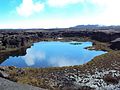 Gladys Lake
 -
 Bartica
 -
 Kamarang Great falls
 -
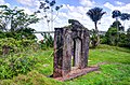 Fort Kai-Kover-All

.jpg)


Territorial claim edit
Venezuela has renewed its claim to the Essequibo region which is situated west of the Essequibo river.[6] The status of the border controversy is subject to the Geneva Agreement, which was signed by the United Kingdom, Venezuela and British Guiana on February 17, 1966. As of December 2020, the matter is being addressed by the ICJ.[7]
See also edit
References edit
- ^ Macmillan Publishers (2009). "Administrative Regions - 1 and 7". Macmillan Junior Atlas: Guyana. Oxford: Macmillan Caribbean. p. 36. ISBN 9780333934173.
- ^ "Guyana Regions". Statoids. Retrieved 19 August 2020.
- ^ Beaie, Sonkarley Tiatun (19 September 2007). "Chapter 3: National Redistribution and Internal Migration" (PDF). 2002 Population and Housing Census - Guyana National Report. Bureau of Statistics. p. 51. Archived from the original (PDF) on 17 February 2012. Retrieved 29 August 2012.
- ^ Beaie, Sonkarley Tiatun (19 September 2007). "National Population Trends: Size, Growth and Distribution" (PDF Download). 2002 Population and Housing Census - Guyana National Report. Bureau of Statistics. p. 25. Retrieved 29 August 2012.
- ^ "2012 Population by Village". Statistics Guyana. Retrieved 8 December 2021.
- ^ "Official Announcements". Archived from the original on 8 September 2016. Retrieved 28 July 2016.
- ^ Summary of the Judgement of 18 December 2020