The Cunningham Highway is a 327-kilometre (203 mi)[1] national highway located in south-eastern Queensland, Australia. The highway links the Darling Downs region with the urbanised outskirts of Ipswich via Cunninghams Gap.[2][3]
Cunningham Highway | |
|---|---|
 | |
| Cunningham Highway (green and black) | |
| General information | |
| Type | Highway |
| Length | 327 km (203 mi) |
| Route number(s) | |
| Major junctions | |
| West end |
|
| |
| East end | |
| Location(s) | |
| Major settlements | Yelarbon, Inglewood, Warwick |
| Highway system | |
The Cunningham carries the National Highway 15 shield between Ipswich and north of Warwick at its junction with the New England Highway at Glengallan where both the Cunningham and the New England head south concurrently to Warwick. Thereafter, the Cunningham carries the National Highway 42 shield to its south-western terminus with the Leichhardt Highway at Goondiwindi. The majority of the Cunningham Highway is a single carriageway with freeway standard and 6-lane arterial road standard towards its north-eastern terminus, near Ipswich.
State-controlled road edit
The Cunningham Highway is a state-controlled road, subdivided into four sections for administrative and funding purposes. Sections 17A, 17B, and part of 17D are part of the National Highway, while section 17C and part of section 17D are strategic roads.[4][5][6][7] The sections are:
- 17A – Goodna to Ipswich
- 17B – Ipswich to Warwick
- 17C – Warwick to Inglewood
- 17D – Inglewood to Goondiwindi
State-controlled roads that intersect with the highway are listed in the main article.
History edit
The highway is named in honour of the explorer and botanist Allan Cunningham who followed a route close to where the modern-day highway runs. In 1828 after discovering the route Cunningham sent a report to Governor Ralph Darling emphasising the economic benefits that a link between the coast and pastoral lands of the Darling Downs would provide.[8] The first road between the coast and the Darling Downs was Spicers Gap Road developed in 1859, which crossed the range at Spicer's Gap and was suitable for the drays used at that time. Although Cunningham's Gap was known at that time, it was considered too steep a route for drays. With the opening of the Southern railway line between Toowoomba and Warwick in 1871, passenger and goods transport switched to the railways and Spicers Gap Road fell into disuse and was not well maintained due to the cost.[9]
It was not until the advent of automobiles that a route through the steep Cunningham's Gap became feasible.[9] The original road was built entirely by voluntary labour and Acting Queensland Premier, William Forgan Smith, officially opened on 11 June 1927, the 100-year anniversary of Allan Cunningham's supposed discovery of Cunningham's Gap.[10] Actually, Cunningham discovered two gaps, Spicer's Gap on 11 June 1827 as he approached from the Darling Downs side and Cunningham's Gap on 21 August 1828 as he approached from Ipswich. However, Cunningham mistakenly believed he had found both sides of the same gap and not two different ones.[11][9] This mistake was then perpetuated on the monument to Cunningham unveiled as part of the official opening of the road, as it gave 11 June 1827 as the discovery of Cunningham's Gap.[12]
The road was plagued by problems during this embryonic stage with the Royal Automobile Club of Queensland announcing that the road was closed, less than one month after it was officially opened.[13] In 1935, the Mains Road Commission upgraded the road to highway and named it the Cunningham Highway.[9] The new sealed road through the gap was eventually opened in November 1949.[14]
Route edit
The north-eastern terminus of the Cunningham Highway is situated a short distance west of where the Warrego Highway reaches its eastern terminus with the Ipswich Motorway, at Riverview, a suburb of Ipswich. From this point, the Cunningham heads south-west as the Cunningham Motorway, bypassing to the south the Ipswich central business district, the original path of the highway, now named Warwick Road. The motorway transitions to the Cunningham Highway, and a further modern deviation takes the highway south of Willowbank and RAAF Base Amberley through the Scenic Rim region including the towns and settlements of Warrill View, the Fassifern Valley and Aratula.[2][15]
From this point, the Cunningham Highway begins its ascent across the Great Dividing Range via a mountain pass at an elevation of 787 metres (2,582 ft) above sea level called Cunninghams Gap, situated in the Main Range National Park, between the peaks of Mount Cordeaux and Mount Mitchell.[15]
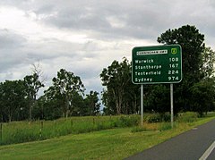
As the Cunningham Highway descends through the Southern Downs region and west adjacent to the settlement of Maryvale, it reaches a major junction with the New England Highway near Eastments Ridge approximately 14 kilometres (8.7 mi) north of Warwick. The two highways run south to Warwick, sharing the National Route 15 shield and cross the Condamine River before the concurrency terminates and the New England Highway runs south, carrying the National Highway 15 shield; and the Cunningham heads west by south-west through Inglewood, Yelarbon, before reaching its south-western terminus on the outskirts of Goondiwindi.[15]
Within close proximity of Goondiwindi, the Cunningham Highway links to the Newell, Leichhardt, and Barwon highways, with the Bruxner Highway nearby.[3][15]
Towns on the Cunningham Highway edit
From northeast to southwest, the following towns and settlements are located on the Cunningham Highway:
Upgrades edit
Highway upgrades edit
A lead project to plan and conduct upgrades to the highway, at a total cost of $212.5 million, was in the planning phase in November 2021. The $25 million intersection upgrade described below is included in this project.[16]
Intersection upgrade edit
A project to upgrade the intersection with the New England Highway east of Warwick, at a cost of $25 million, was due for completion in August 2022.[17]
Reconstruction works edit
A project to reconstruct sections of the highway at Cunninghams Gap following bushfire damage, at a cost of $84.27 million, was due to start construction in early 2022.[18]
Safety upgrades edit
A project to identify safety issues and propose solutions between Warwick and Inglewood, at a cost of $275,000, was under way in January 2022.[19]
Major exits and intersections edit
| LGA | Location | km[1] | mi | Destinations | Notes |
|---|---|---|---|---|---|
| Ipswich | Riverview | 0 | 0.0 | North western terminus via motorway-grade underpass | |
| 0 | 0.0 | No westbound exit to M2 westbound; No southwest bound entrance from M2 eastbound | |||
| Blackstone | 4.6 | 2.9 | Southwest bound exit and northeast bound entrance | ||
| 5.7 | 3.5 | Northeast bound exit and southwest bound entrance | |||
| Raceview | 7.7 | 4.8 | Swanbank Road – Swanbank, Raceview | Southwest bound exit and southwest bound entrance | |
| 8.8 | 5.5 | South Station Road – Raceview, Swanbank | Northeast bound exit and northeast bound entrance | ||
| Flinders View | 9.8 | 6.1 | Ripley Road – Flinders View, Ripley | Southwest bound exit and southwest bound entrance; Northeast bound exit and northeast bound entrance | |
| Deebing Heights, Yamanto, Purga | 14.3 | 8.9 | No southbound exit to A5 southwest bound; No northeast bound entrance from A5 northbound | ||
| 14.9 | 9.3 | ||||
| 14.9 | 9.3 | Warwick Road north – Yamanto | |||
| 15.7 | 9.8 | End of motorway conditions, beginning of highway conditions southwest bound; End of highway conditions, beginning of motorway conditions northeast bound | |||
| Willowbank | 19.2 | 11.9 | Ipswich-Rosewood Road northwest – Amberley | ||
| Scenic Rim | Fassifern | 56.5 | 35.1 | ||
| Southern Downs | Glengallan | 115.6 | 71.8 | A15 northern concurrency terminus | |
| Warwick | 126.6 | 78.7 | Condamine River | Bridge over river | |
| 129.4 | 80.4 | A15 southern concurrency terminus | |||
| 129.4 | 80.4 | Cunningham Highway continues as | |||
| Karara | 178 | 111 | |||
| Goondiwindi | Oman Ama, Coolmunda | 216.7 | 134.7 | Eastern concurrency terminus for Alternate State Route 89 | |
| Inglewood | 234.4 | 145.6 | |||
| 236.4 | 146.9 | Western concurrency terminus for Alternate State Route 89 | |||
| Goondiwindi | 324.2 | 201.4 | (to | Bypass does not carry the shields, although named as the Leichhardt Highway | |
| 327 | 203 | South-western highway terminus at roundabout | |||
1.000 mi = 1.609 km; 1.000 km = 0.621 mi
| |||||
Gallery edit
-
 section under conversion to
-
 Cunningham Highway at Cunningham's Gap


See also edit
References edit
- ^ a b Google (2 April 2015). "Cunningham Highway" (Map). Google Maps. Google. Retrieved 2 April 2015.
- ^ a b "South-east Queensland coast (map 7)" (PDF) (Map). Guide to Queensland Roads. Department of Transport and Main Roads, Queensland Government. 16 September 2013. Archived from the original (PDF) on 3 April 2015. Retrieved 31 March 2015.
- ^ a b "South-west Queensland Downs (map 6)" (PDF) (Map). Guide to Queensland Roads. Department of Transport and Main Roads, Queensland Government. 16 September 2013. Archived from the original (PDF) on 4 April 2015. Retrieved 31 March 2015.
- ^ The State Road Network of Queensland (PDF) (Map). Queensland Government ©State of Queensland [CC BY 4.0]. 30 June 2022. Retrieved 4 August 2023.
- ^ "Metropolitan district map" (PDF). Department of Transport and Main Roads ©State of Queensland [CC BY 4.0]. 2020. Retrieved 18 August 2022.
- ^ "South Coast district map" (PDF). Department of Transport and Main Roads ©State of Queensland [CC BY 4.0]. 2022. Retrieved 25 December 2023.
- ^ "Darling Downs district map" (PDF). Department of Transport and Main Roads ©State of Queensland [CC BY 4.0]. 2019. Retrieved 1 January 2022.
- ^ Queensland Environmental Protection Agency (2000). Heritage Trails of the Great South East. State of Queensland. p. 35. ISBN 0-7345-1008-X.
- ^ a b c d "Spicers Gap Road Conservation Park (entry 601732)". Queensland Heritage Register. Queensland Heritage Council. Retrieved 1 August 2014.
- ^ "NEW EAST-WEST ROUTE". Warwick Daily News. No. 2489. Queensland, Australia. 13 June 1927. p. 6. Retrieved 9 December 2016 – via National Library of Australia.
- ^ "Cunningham's Gap". The Brisbane Courier. Qld.: National Library of Australia. 13 June 1927. p. 13. Retrieved 12 August 2011.
- ^ "Allan Cunningham". Monument Australia. Retrieved 9 December 2016.
- ^ "Week-end Trips – State of Roads – Royal Automobile Club's Reports". The Brisbane Courier. Qld.: National Library of Australia. 2 July 1927. p. 18. Retrieved 14 August 2011.
- ^ "Minister opens new highway". The Courier-Mail. Qld.: National Library of Australia. 7 November 1949. p. 3. Retrieved 13 September 2011.
- ^ a b c d "Map of Cunningham Highway, QLD". Bonzle Digital Atlas of Australia. Retrieved 31 March 2015.
- ^ "Cunningham Highway Upgrade". Queensland Government. 22 November 2021. Retrieved 4 June 2022.
- ^ "Cunningham Highway (Ipswich-Warwick), Eight Mile intersection upgrade". Queensland Government. 19 May 2022. Retrieved 4 June 2022.
- ^ "Cunningham Highway (Ipswich-Warwick), 2020 Disaster Recovery Funding Arrangements reconstruction works". Queensland Government. 4 April 2022. Retrieved 4 June 2022.
- ^ "Cunningham Highway safety upgrades - Warwick to Inglewood". 17 January 2022. Retrieved 4 June 2022.
External links edit
![]() Media related to Cunningham Highway at Wikimedia Commons
Media related to Cunningham Highway at Wikimedia Commons