Blakstad or Blakstad-Osedalen is a village which is also the administrative centre of the municipality of Froland in Agder county, Norway. It is located along the river Nidelva, about 10 kilometres (6.2 mi) northwest of the town of Arendal (where many residents of Blakstad work and shop). The small village of Froland lies about 3 kilometres (1.9 mi) to the north, on the west side of the river, and that is where Froland Church is located.[3]
Blakstad
Blakstad-Osedalen | |
|---|---|
Village | |
 View of the Nidelva river through Blakstad | |
 Blakstad Location of the village  Blakstad Blakstad (Norway) | |
| Coordinates: 58°30′19″N 8°38′36″E / 58.5054°N 08.6433°E | |
| Country | Norway |
| Region | Southern Norway |
| County | Agder |
| District | Østre Agder |
| Municipality | Froland |
| Area | |
| • Total | 2.6 km2 (1.0 sq mi) |
| Elevation | 58 m (190 ft) |
| Population (2019)[1] | |
| • Total | 3,241 |
| • Density | 1,244/km2 (3,220/sq mi) |
| Time zone | UTC+01:00 (CET) |
| • Summer (DST) | UTC+02:00 (CEST) |
| Post Code | 4820 Froland |
Originally, Blakstad was the village on the eastern shore of the river and the village of Osedalen was located on the western side of the river. Over the years, the two villages grew together and now form one large village. The 2.6-square-kilometre (640-acre) village has a population (2019) of 3,241 and a population density of 1,244 inhabitants per square kilometre (3,220/sq mi).[1]
The Arendalsbanen railway line, a branch of the Sørlandsbanen railway line stops at the Blakstad Station. The Norwegian County Road 42 and Norwegian County Road 408 also run through the village.[3]
Media gallery edit
-
 Blakstad school
 -
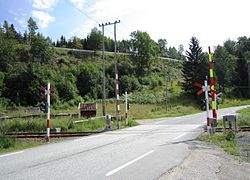 Railroad crossing on FV 408
 -
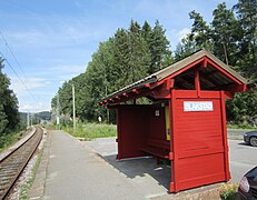 Blakstad railway station


See also edit
References edit
- ^ a b c Statistisk sentralbyrå (1 January 2019). "Urban settlements. Population and area, by municipality".
- ^ "Blakstad, Froland (Aust-Agder)". yr.no. Retrieved 2017-12-12.
- ^ a b Thorsnæs, Geir, ed. (2017-06-17). "Blakstad – tettsted". Store norske leksikon (in Norwegian). Kunnskapsforlaget. Retrieved 2017-12-12.
This Agder location article is a stub. You can help Wikipedia by expanding it. |